IMAGES TAKEN NEAR TO
Wyesham Avenue, MONMOUTH, NP25 3NE
Introduction
This page details the photographs taken nearby to Wyesham Avenue, NP25 3NE by members of the Geograph project.
The Geograph project started in 2005 with the aim of publishing, organising and preserving representative images for every square kilometre of Great Britain, Ireland and the Isle of Man.

There are currently over 7.5m images from over14,400 individuals and you can help contribute to the project by visiting https://www.geograph.org.uk
Image Map (Loading...)


Getting Data...Please wait
Leaflet Map data © OpenStreetMap
Images are licensed for reuse under creativecommons.org/licenses/by-sa/2.0
Notes
- Clicking on the map will re-center to the selected point.
- The higher the marker number, the further away the image location is from the centre of the postcode.
Image Listing (106 Images Found)
Images are licensed for reuse under creativecommons.org/licenses/by-sa/2.0
Image
Details
Distance
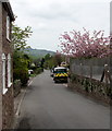
1
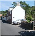
Valentine Cottage, Wyesham
One of the older buildings in Wyesham, located near the church. http://www.geograph.org.uk/photo/2395510
Image: © Jaggery
Taken: 2 May 2011
0.06 miles
2
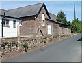
Church hall, Wyesham
Located at the southern edge of the church of St James. http://www.geograph.org.uk/photo/2395494
Image: © Jaggery
Taken: 2 May 2011
0.06 miles
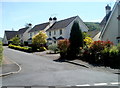
3
Bungalows on the corner of Wyesham Avenue and Chapel Close, Wyesham, Monmouth
Viewed across Wyesham Avenue.
Image: © Jaggery
Taken: 2 May 2011
0.07 miles
4
Chapel Close houses, Wyesham
Houses on the north side of Chapel Close viewed from the Wyesham Avenue end.
Image: © Jaggery
Taken: 2 May 2011
0.07 miles
5
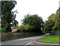
Wyesham Avenue, Wyesham
Looking towards Redbrook Road from the Wyesham Road end of Wyesham Avenue.
Image: © Jaggery
Taken: 26 Apr 2015
0.07 miles
6
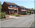
Church Farm houses, Monmouth
Viewed from the corner of Wyesham Avenue.
Image: © Jaggery
Taken: 2 May 2011
0.08 miles
7
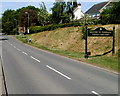
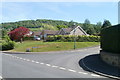
Welcome to Monmouth
The A466 from Chepstow through the Wye Valley (via Tintern) reaches Monmouth.
Ahead is the Wyesham area of the town.
Image: © Jaggery
Taken: 2 May 2011
0.08 miles
8
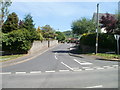
Wyesham Avenue, Monmouth
Wyesham Avenue heads away from Redbrook Road (A466) into Wyesham.
Image: © Jaggery
Taken: 2 May 2011
0.08 miles
10
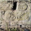
Ordnance Survey Cut Mark
This OS cut mark can be found on the school wall. It marks a point 37.942m above mean sea level.
Image: © Adrian Dust
Taken: 30 Jan 2019
0.09 miles