IMAGES TAKEN NEAR TO
School Street, NEW TREDEGAR, NP24 6NG

Introduction

This page details the photographs taken nearby to School Street, NP24 6NG by members of the Geograph project.

The Geograph project started in 2005 with the aim of publishing, organising and preserving representative images for every square kilometre of Great Britain, Ireland and the Isle of Man.

There are currently over 7.5m images from over14,400 individuals and you can help contribute to the project by visiting https://www.geograph.org.uk

Image Map


Images are licensed for reuse under creativecommons.org/licenses/by-sa/2.0
Notes
  • Clicking on the map will re-center to the selected point.
  • The higher the marker number, the further away the image location is from the centre of the postcode.

Image Listing (135 Images Found)

Images are licensed for reuse under creativecommons.org/licenses/by-sa/2.0
  • ...
Image
Details
Distance
1
New Tredegar
Image: © william rogers Taken: 4 Jun 2012
0.03 miles
2
Elliotstown Clock
Image: © william rogers Taken: 29 Aug 2012
0.03 miles
3
New Tredegar clock
Image: © andy dolman Taken: 18 Sep 2008
0.04 miles
4
Clock Tower, New Tredegar
A plaque on the clock states "Erected in memory of the late Samuel Ronald MacMillan physician and surgeon by his grateful patients and friends". Behind the clock are the terraces of Elliot's Town.
Image: © Robin Drayton Taken: 12 Nov 2008
0.04 miles
5
Overlooking New Tredegar
Looking down onto and across the Rhymney Valley. Taken from a minor road from Tirphil that ascends Cefn y Brithdir, the ridge between the Rhymney Valley and the Darran Valley.
Image: © Robin Drayton Taken: 21 Nov 2013
0.05 miles
6
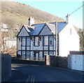
Elliot House, New Tredegar
Located on a bend in Bedwellty Road. The name Elliot features in several locations in New Tredegar. Elliot's Colliery, (1888-1967) at its peak employed nearly 3,000 men. There is an Elliot Street nearby, and a district of the town is name Elliot's Town.
Image: © Jaggery Taken: 20 Jan 2011
0.07 miles
7
Road to Phillip's Town, New Tredegar
An unnamed road heads away from Bedwellty Road towards the east side of Phillip's Town.
Image: © Jaggery Taken: 20 Jan 2011
0.07 miles
8
Duffryn Terrace, Elliot's Town, New Tredegar
Once the main road through the valley. Now only used by local traffic.
Image: © Robin Drayton Taken: 27 Jun 2013
0.07 miles
9
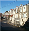
Fothergills Road houses, New Tredegar
Viewed from the NW end of School Street near the point where it becomes Duffryn Terrace, just beyond the left edge of the view. Fothergills Road houses are behind the no entry signs.
Image: © Jaggery Taken: 20 Jan 2011
0.07 miles
10
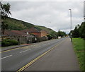
NW along White Rose Way, New Tredegar
Looking to the northwest along the A4049 White Rose Way towards the centre of New Tredegar.
Image: © Jaggery Taken: 5 Jun 2019
0.07 miles
  • ...