IMAGES TAKEN NEAR TO
Park View, EBBW VALE, NP23 6UD
Introduction
This page details the photographs taken nearby to Park View, NP23 6UD by members of the Geograph project.
The Geograph project started in 2005 with the aim of publishing, organising and preserving representative images for every square kilometre of Great Britain, Ireland and the Isle of Man.

There are currently over 7.5m images from over14,400 individuals and you can help contribute to the project by visiting https://www.geograph.org.uk
Image Map
Images are licensed for reuse under creativecommons.org/licenses/by-sa/2.0
Notes
- Clicking on the map will re-center to the selected point.
- The higher the marker number, the further away the image location is from the centre of the postcode.
Image Listing (69 Images Found)
Images are licensed for reuse under creativecommons.org/licenses/by-sa/2.0
Image
Details
Distance
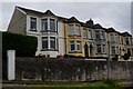
1
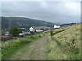
Park View Street houses Waunlwyd
The houses are at the southern end of Park View Street. Behind them are houses in Excelsior Street.
Image: © Jaggery
Taken: 10 Sep 2013
0.02 miles
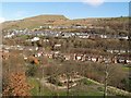
3
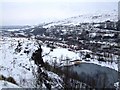
Looking North towards Ebbw Vale over the former Festival Park Site
Bleak snowscene looking over the former Festival Park site. Taken from the most southerly manmade rocky outcrop (above the Pagoda and Lakes)
Image: © Matthew Lane
Taken: 4 Feb 2009
0.04 miles
5
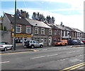
Smiling Valley, Waunlwyd
Chinese takeaway at 7 Park Place, Waunlwyd.
Image: © Jaggery
Taken: 10 Sep 2013
0.08 miles
6
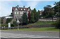
The Ambala, Waunlwyd
The Ambala Indian restaurant, bar and hotel is located between Station Road (A4046) and Dyffryn Road (B4486). The Ambala opened in August 2013. The building was previously the Park Hotel.
Image: © Jaggery
Taken: 10 Sep 2013
0.09 miles
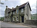
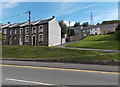
8
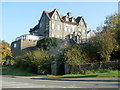
Park Hotel, Waunlwyd, Ebbw Vale
Set back from the junction of Station Road (A4046) and Dyffryn Road (B4486).
Waunlwyd is part of the Ebbw Vale conurbation, south of Ebbw Vale town and north of Cwm.
Update September 2013. The building is now The Ambala. http://www.geograph.org.uk/photo/3666058
Image: © Jaggery
Taken: 29 Sep 2011
0.10 miles
9

Long row of houses in Brynhyfryd Terrace, Ebbw Vale
The row extends for 100 metres. Viewed from the southern end of Ebbw Vale Parkway railway station.
Image: © Jaggery
Taken: 16 May 2014
0.11 miles