IMAGES TAKEN NEAR TO
Garn Terrace, EBBW VALE, NP23 6TX

Introduction

This page details the photographs taken nearby to Garn Terrace, NP23 6TX by members of the Geograph project.

The Geograph project started in 2005 with the aim of publishing, organising and preserving representative images for every square kilometre of Great Britain, Ireland and the Isle of Man.

There are currently over 7.5m images from over14,400 individuals and you can help contribute to the project by visiting https://www.geograph.org.uk

Image Map


Images are licensed for reuse under creativecommons.org/licenses/by-sa/2.0
Notes
  • Clicking on the map will re-center to the selected point.
  • The higher the marker number, the further away the image location is from the centre of the postcode.

Image Listing (77 Images Found)

Images are licensed for reuse under creativecommons.org/licenses/by-sa/2.0
  • ...
Image
Details
Distance
1
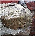
Ordnance Survey Cut Mark
This OS cut mark can be found on the wall NE side of the road. It marks a point 289.581m above mean sea level.
Image: © Adrian Dust Taken: 18 Aug 2018
0.05 miles
2
Ordnance Survey Rivet
This OS rivet can be found on the wall of No1 Bryn Terrace. It marks a point 276.594m above mean sea level.
Image: © Adrian Dust Taken: 18 Aug 2018
0.06 miles
3
Park hotel
Image: © andy dolman Taken: 16 Feb 2009
0.08 miles
4
Park Hotel, Ebbw Vale
Image: © Alan Hughes Taken: 13 Aug 2024
0.11 miles
5
The Ambala, Waunlwyd
The Ambala Indian restaurant, bar and hotel is located between Station Road (A4046) and Dyffryn Road (B4486). The Ambala opened in August 2013. The building was previously the Park Hotel.
Image: © Jaggery Taken: 10 Sep 2013
0.11 miles
6
Station Road, Victoria, Ebbw Vale
Image: © Ian S Taken: 25 May 2014
0.12 miles
7
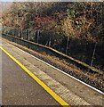
Remains of a former Ebbw Vale Victoria station platform
Wire fencing and vegetation is on the remains of the platform opposite the single-track single-platform Ebbw Vale Parkway station which opened in February 2008 on the site of the former Victoria station. Victoria opened in 1852, closed at the end of April 1962.
Image: © Jaggery Taken: 8 Dec 2022
0.12 miles
8
Footbridge on the north side of Ebbw Vale Parkway railway station
Viewed from Glan Ebbw Terrace. The footbridge over a railway line leads to Station Road.
Image: © Jaggery Taken: 16 May 2014
0.13 miles
9
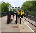
Departure from Ebbw Vale Parkway station towards Ebbw Vale Town station
Viewed in late May 2015. When I was last here in 2014, Ebbw Vale Parkway was the northern terminus of the line from Cardiff Central. From Sunday May 17th 2015 it has been a through station after the opening of the northern extension of the line to the new terminus at Ebbw Vale Town station. http://www.geograph.org.uk/photo/4479502
Image: © Jaggery Taken: 27 May 2015
0.13 miles
10
Stop sign at the northern end of Ebbw Vale Parkway railway station
A rusty single track extends northwards from the edge of the single platform at Ebbw Vale Parkway, currently (May 2014) the northern terminus of the route from Cardiff. The track ends about 150 metres beyond the footbridge. A year earlier, the Welsh Government had announced that £11.5 million had been allocated to extend the railway into the town centre and the building of a new station, to be named Ebbw Vale Town. Ebbw Vale Parkway is at the southern edge of town, about 2 miles (c3.2 km) from Ebbw Vale Civic Centre.
Image: © Jaggery Taken: 16 May 2014
0.13 miles
  • ...