1
Ordnance Survey Cut Mark
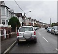
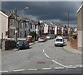
This OS cut mark can be found on the gatepost of No44 Emlyn Avenue. It marks a point 303.849m above mean sea level.
Image: © Adrian Dust
Taken: 4 Oct 2018
0.04 miles
2
Ebbw Vale Fire Station
Ebbw Vale Fire Station, Cemetery Road, Ebbw Vale is part of the South Wales Fire & Rescue Service
Image: © Kevin Hale
Taken: 4 Jun 2007
0.09 miles
3
Lilian Grove houses, Ebbw Vale
The backs of Lilian Grove houses viewed from Beaufort Road.
Image: © Jaggery
Taken: 10 Sep 2017
0.13 miles
4
Path towards Lilian Grove, Ebbw Vale
From Beaufort Road.
Image: © Jaggery
Taken: 10 Sep 2017
0.14 miles
5
Badminton Grove cars and houses, Ebbw Vale
Badminton Grove ascends from Beaufort Road into the Glyncoed area of Ebbw Vale.
Image: © Jaggery
Taken: 10 Sep 2017
0.14 miles
6
SE end of Badminton Grove, Ebbw Vale
Looking NW along Badminton Grove from Beaufort Road.
Image: © Jaggery
Taken: 10 Sep 2013
0.15 miles
7
Beaufort Road Hand Car Wash, Ebbw Vale
Set back from the west side of Beaufort Road. In September 2017,
the nameboard shows that this car wash is open from 8:30am-6pm seven days a week.
Image: © Jaggery
Taken: 10 Sep 2017
0.15 miles
8
Up Badminton Grove, Ebbw Vale
Badminton Grove ascends from Beaufort Road into the Glyncoed area of Ebbw Vale.
Image: © Jaggery
Taken: 10 Sep 2017
0.16 miles
9
Old-style name sign, Badminton Grove, Ebbw Vale
At first floor level on the wall of a house at the southeast end/start of Badminton Grove.
Image: © Jaggery
Taken: 10 Sep 2017
0.16 miles
10
Memorial on the site of the demolished Beaufort Road Methodist Chapel, Ebbw Vale
Beaufort Road Methodist Chapel was built in 1825, closed in 1861. This memorial was erected in 1873 by the friends of the Newport Eisteddfod to the memory of the Revd. John Emlyn Jones MA LLD (1822-1873). He was for many years minister of the chapel.
Image: © Jaggery
Taken: 10 Sep 2017
0.16 miles


