IMAGES TAKEN NEAR TO
Somerset Street, EBBW VALE, NP23 4YG
Introduction
This page details the photographs taken nearby to Somerset Street, NP23 4YG by members of the Geograph project.
The Geograph project started in 2005 with the aim of publishing, organising and preserving representative images for every square kilometre of Great Britain, Ireland and the Isle of Man.

There are currently over 7.5m images from over14,400 individuals and you can help contribute to the project by visiting https://www.geograph.org.uk
Image Map
Images are licensed for reuse under creativecommons.org/licenses/by-sa/2.0
Notes
- Clicking on the map will re-center to the selected point.
- The higher the marker number, the further away the image location is from the centre of the postcode.
Image Listing (322 Images Found)
Images are licensed for reuse under creativecommons.org/licenses/by-sa/2.0
Image
Details
Distance
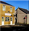
1
Beaufort Street, Brynmawr
Photo taken from the car park.
Image: © Kev Griffin
Taken: 14 Nov 2004
0.03 miles
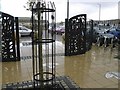
3
Town Centre Car Park, Brynmawr
The free car park is accessed by car from Worcester Street http://www.geograph.org.uk/photo/4813889 and also from Beaufort Street on foot.
A plaque on a nearby wall records that the car park was officially opened on June 5th 2003.
Image: © Jaggery
Taken: 2 Feb 2016
0.04 miles
5
Dumfries Place name sign, Brynmawr
The sign on the corner of King Street shows that Dumfries Place leads to St Mary the Virgin church. http://www.geograph.org.uk/photo/4830378
Image: © Jaggery
Taken: 2 Feb 2016
0.05 miles
6
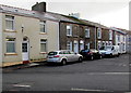
Houses on the east side of Bailey Street, Brynmawr
Viewed across the A4047 King Street.
Image: © Jaggery
Taken: 2 Feb 2016
0.05 miles
7
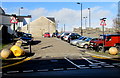
Town Centre Car Park entrance, Brynmawr
From Worcester Street 30 metres east of Beaufort Street. Free parking here for cars and motor bikes. Commercial vehicles not exceeding 2.5 tonnes unladen weight can also park here.
Vehicles can be left here for a maximum of 24 hours.
Image: © Jaggery
Taken: 2 Feb 2016
0.06 miles
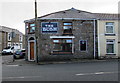
8
King Street Antiques & Collectibles, Brynmawr
King Street shop on the corner of Queen Street, viewed in early February 2016.
The shop name was Lake's in this http://www.geograph.org.uk/photo/1819842 April 2010 photo.
Image: © Jaggery
Taken: 2 Feb 2016
0.06 miles
9
King Street side of The Bush, Brynmawr
The north side of the pub http://www.geograph.org.uk/photo/4826747 on the corner of Bailey Street.
Image: © Jaggery
Taken: 2 Feb 2016
0.06 miles