IMAGES TAKEN NEAR TO
Station Terrace, EBBW VALE, NP23 4QF
Introduction
This page details the photographs taken nearby to Station Terrace, NP23 4QF by members of the Geograph project.
The Geograph project started in 2005 with the aim of publishing, organising and preserving representative images for every square kilometre of Great Britain, Ireland and the Isle of Man.

There are currently over 7.5m images from over14,400 individuals and you can help contribute to the project by visiting https://www.geograph.org.uk
Image Map
Images are licensed for reuse under creativecommons.org/licenses/by-sa/2.0
Notes
- Clicking on the map will re-center to the selected point.
- The higher the marker number, the further away the image location is from the centre of the postcode.
Image Listing (22 Images Found)
Images are licensed for reuse under creativecommons.org/licenses/by-sa/2.0
Image
Details
Distance
1
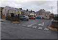
Garn Cross Car Park, Nantyglo
Small free car park on the south side of the street named Garn Cross.
Image: © Jaggery
Taken: 14 Jun 2013
0.08 miles
2
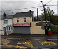
Tasty Garden, Nantyglo
Chinese and Cantonese cuisine takeaway located at the SE end of King Street, at number 96.
Image: © Jaggery
Taken: 14 Jun 2013
0.09 miles
3
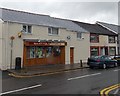
Nantyglo Stores, Nantyglo
Convenience stores in King Street.
Image: © Jaggery
Taken: 14 Jun 2013
0.10 miles
4
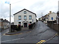
Garn IT, Nantyglo
Technology services business at 39 Garn Cross, at the junction with Garn Road on the right.
Image: © Jaggery
Taken: 14 Jun 2013
0.10 miles
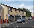
5
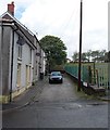
Co-operative Terrace, Nantyglo
Short terrace of 3 houses, viewed from Ffosmaen Road.
Image: © Jaggery
Taken: 14 Jun 2013
0.12 miles
6
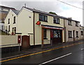
Nantyglo Village Store and Post Office
Located at 69 King Street, Nantyglo.
Image: © Jaggery
Taken: 14 Jun 2013
0.12 miles
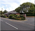
7
Site of the demolished Hermon Baptist Church, Nantyglo
Viewed across the street named Garn Cross. A black plaque on the wall behind the bus stop records that this was the site of Hermon Baptist Church from 1820 until 1987. The site is now occupied by Nantyglo Medical Centre. http://www.geograph.org.uk/photo/3570771
Image: © Jaggery
Taken: 14 Jun 2013
0.12 miles
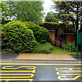
8
Nantyglo Medical Centre
Viewed across Queen Street. This site was occupied by Hermon Baptist Church from 1820-1987.
Image: © Jaggery
Taken: 26 Jul 2013
0.13 miles
9
Sold sign on former Ken Finney Motorcycles shop, Nantyglo
Viewed across Queen Street in late July 2013.
Image: © Jaggery
Taken: 26 Jul 2013
0.15 miles
10
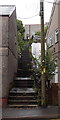
Steps from King Street to Prince Street, Nantyglo
The short cut bends to the left at the top of these steps.
Image: © Jaggery
Taken: 14 Jun 2013
0.16 miles