1
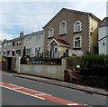
Gwaun Delyn Close bungalows, Nantyglo
On the west side of Queen Street, Nantyglo.
Image: © Jaggery
Taken: 26 Jul 2013
0.00 miles
2
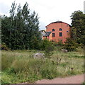
Former Bethel chapel, Nantyglo
Viewed across Queen Street. Now converted to a private residence, the building on the right was erected in 1867 as Bethel English Baptist chapel. The "English" in the name denoted the language used for services in an area that was mainly Welsh speaking at the time.
Image: © Jaggery
Taken: 26 Jul 2013
0.05 miles
3
Queen Street, Nantyglo
Image: © andy dolman
Taken: 11 Jan 2010
0.05 miles
4
Berea Cottages, Blaina
The cottages are located near the former Berea United Reformed Chapel, now a masjid. http://www.geograph.org.uk/photo/3659906
Image: © Jaggery
Taken: 18 Sep 2013
0.08 miles
5
Houses on Queen Street, Nantyglo
Image: © Ian S
Taken: 24 May 2014
0.08 miles
6
Parking area at the edge of Coed y Garn Primary School, Nantyglo
The parking area is alongside Queen Street at the corner of Parrot Row. http://www.geograph.org.uk/photo/3571882
Image: © Jaggery
Taken: 26 Jul 2013
0.09 miles
7
Road to Lower Coedcae, Nantyglo
Viewed across Queen Street. A sign on the right corner points towards Lower Coedcae.
Image: © Jaggery
Taken: 26 Jul 2013
0.10 miles
8
Ebbw Fach Trail heads away from Coalbrookvale, Nantyglo
Viewed from this http://www.geograph.org.uk/photo/3571772 entrance.
Image: © Jaggery
Taken: 26 Jul 2013
0.10 miles
9
Berea Masjid in Blaina
Operated by the Imaan Islamic Society, the Sunni (Traditional) masjid (mosque) occupies the converted former Berea United Reformed Chapel.
Image: © Jaggery
Taken: 18 Sep 2013
0.11 miles
10
West side of Berea Masjid, Blaina
The masjid http://www.geograph.org.uk/photo/3659906 occupies the converted former Berea United Reformed Chapel.
Image: © Jaggery
Taken: 18 Sep 2013
0.11 miles


