IMAGES TAKEN NEAR TO
Worcester Street, EBBW VALE, NP23 4DE
Introduction
This page details the photographs taken nearby to Worcester Street, NP23 4DE by members of the Geograph project.
The Geograph project started in 2005 with the aim of publishing, organising and preserving representative images for every square kilometre of Great Britain, Ireland and the Isle of Man.

There are currently over 7.5m images from over14,400 individuals and you can help contribute to the project by visiting https://www.geograph.org.uk
Image Map
Images are licensed for reuse under creativecommons.org/licenses/by-sa/2.0
Notes
- Clicking on the map will re-center to the selected point.
- The higher the marker number, the further away the image location is from the centre of the postcode.
Image Listing (276 Images Found)
Images are licensed for reuse under creativecommons.org/licenses/by-sa/2.0
Image
Details
Distance
1
Worcester Street, King Street, Brynmawr
Image: © Alex McGregor
Taken: 8 Jun 2011
0.04 miles
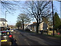
4
Trafalgar Road, Brynmawr
Viewed from Alma Street looking along Trafalgar Road towards King Street.
Image: © Jaggery
Taken: 2 Feb 2016
0.05 miles
5
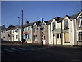
Houses in King St, Brynmawr
Some of the rendering has been removed from the nearest one, revealing the masonry construction.
Image: © John Lord
Taken: 11 Feb 2012
0.05 miles
6
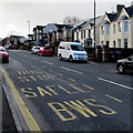
Alma Street bus stop, Brynmawr
For buses towards the town centre, viewed from the corner of Greenland Road.
SAFLE BWS is Welsh for BUS STOP.
Image: © Jaggery
Taken: 2 Feb 2016
0.06 miles
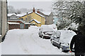
7
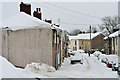
Brynmawr side street
Worth looking at the huge icicles
Image: © andy dolman
Taken: 13 Jan 2010
0.06 miles
8
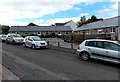
Trafalgar Close, Brynmawr
Single-storey houses viewed across Greenland Road near the Alma Street junction.
Image: © Jaggery
Taken: 14 Sep 2013
0.06 miles
9
Corner of Alma Street and Trafalgar Road, Brynmawr
Viewed across Alma Street. Some maps show Trafalgar Road as Pound Road, perhaps an earlier name. The name sign on the right shows Trafalgar Road.
Image: © Jaggery
Taken: 7 Jun 2013
0.06 miles
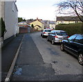
10
Southern end of Intermediate Road, Brynmawr
The 20mph speed limit on Intermediate Road increases to 30mph at the A4047 King Street junction.
Image: © Jaggery
Taken: 2 Feb 2016
0.06 miles