IMAGES TAKEN NEAR TO
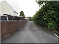
Shoemaker Close, EBBW VALE, NP23 4AU
Introduction
This page details the photographs taken nearby to Shoemaker Close, NP23 4AU by members of the Geograph project.
The Geograph project started in 2005 with the aim of publishing, organising and preserving representative images for every square kilometre of Great Britain, Ireland and the Isle of Man.

There are currently over 7.5m images from over14,400 individuals and you can help contribute to the project by visiting https://www.geograph.org.uk
Image Map
Images are licensed for reuse under creativecommons.org/licenses/by-sa/2.0
Notes
- Clicking on the map will re-center to the selected point.
- The higher the marker number, the further away the image location is from the centre of the postcode.
Image Listing (116 Images Found)
Images are licensed for reuse under creativecommons.org/licenses/by-sa/2.0
Image
Details
Distance
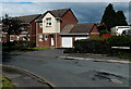
1
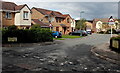
Shoemaker Close, Brynmawr
Viewed from Old Blaenavon Road.
Image: © Jaggery
Taken: 14 Sep 2013
0.02 miles
2
Darren-Felin Road, Brynmawr
Viewed across the A467.
Image: © Jaggery
Taken: 14 Sep 2013
0.05 miles
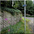
3
Darren-Felin Road, Brynmawr
Ascending from the east side of the A467. A nearby sign http://www.geograph.org.uk/photo/5503796 shows that the road ahead is part of National Cycle Network 46.
Image: © Jaggery
Taken: 18 Aug 2017
0.05 miles
4
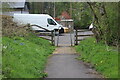
Path from end of Darren Felin Road
Squeeze stile where bridle path meets the highway.
Image: © M J Roscoe
Taken: 7 May 2023
0.05 miles
5
New houses in Old Blaenavon Road, Brynmawr
Looking towards Shoemaker Close.
Image: © Jaggery
Taken: 14 Sep 2013
0.06 miles
6
Cycle route 46 direction sign on a Brynmawr corner
The sign facing the A467 points left towards Darren-Felin Road. http://www.geograph.org.uk/photo/5503766 In August 2017, the Sustrans website states that National Cycle Network Route 46 will connect Bromsgrove with Neath when complete.
Image: © Jaggery
Taken: 18 Aug 2017
0.07 miles
7
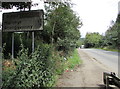
Grimy sign alongside the A467, Brynmawr
Grimy in mid August 2017, the sign showing Merthyr 11 (miles) Abergavenny 7 faces
northbound traffic on the A467 on the approach to the A465 Heads of the Valleys Road junction.
Image: © Jaggery
Taken: 18 Aug 2017
0.08 miles
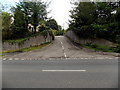
8
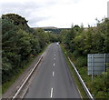
Along the A467 towards the Heads of the Valley Road in Brynmawr
Viewed from this http://www.geograph.org.uk/photo/3736070 footbridge. The roundabout at the Heads of the Valleys Road (A465) junction is about 150 metres out of shot ahead.
Image: © Jaggery
Taken: 14 Sep 2013
0.08 miles
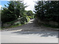
9
Daren Felin Road, Brynmawr
Ascending from the corner of Greenland Road and Alma Street.
Image: © Jaggery
Taken: 18 Aug 2017
0.08 miles
10
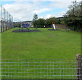
Children's play area in the Recreation Ground, Brynmawr
In the NW corner of the recreation ground, near Old Blaenavon Road.
Image: © Jaggery
Taken: 14 Sep 2013
0.08 miles