1
Susannah Houses, Rhymney
Another view of these 200 year old houses http://www.geograph.org.uk/photo/2930445 .
Image: © Robin Drayton
Taken: 7 Apr 2012
0.10 miles
2
Susannah Houses, Rhymney
These houses are scheduled for conservation.
Dating from the early 19th century, they are Grade II listed as a rare surviving example of early industrial housing in S Wales, little altered, and for their associations with the important Rhymney Iron Company.
Susannah was the sister of the local ironmaster, Richard Crawshay.
Image: © Robin Drayton
Taken: 7 Apr 2012
0.10 miles
3
Minor road from Bryn-oer Patch to Rhymney
This road is the route of an old dram road along which mining products were taken beyond the distant hills to the Crawshay's ironworks in Merthyr Tydfil.
For a view a little further along the road see http://www.geograph.org.uk/photo/2932915 .
Image: © Robin Drayton
Taken: 7 Apr 2012
0.14 miles
4
Ty Coch, Rhymney
Housing on the north-eastern edge of the town.
Image: © Robin Drayton
Taken: 30 Jan 2013
0.16 miles
5
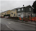
Aneurin Terrace houses, Rhymney
Viewed across speed bumps.
Image: © Jaggery
Taken: 5 Apr 2019
0.16 miles
6
Unnamed road ascending from Aneurin Terrace, Rhymney
Towards residential streets named Is-Fryn, Heol-y-Twyn and Heol Uchaf.
Image: © Jaggery
Taken: 5 Apr 2019
0.17 miles
7
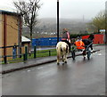
Horse rider and sulky rider, Aneurin Terrace, Rhymney
A sulky is a light two-wheeled horse-drawn vehicle for one person.
Image: © Jaggery
Taken: 5 Apr 2019
0.17 miles
8
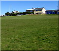
Houses on top of a steep grassy bank, Rhymney
Ael-y-bryn houses viewed from the B4257.
Image: © Jaggery
Taken: 11 Apr 2019
0.17 miles
9
Aneurin Terrace houses, Rhymney
This northern part of Rhymney is c320 metres (about 1,050 ft) above mean sea level.
Image: © Jaggery
Taken: 5 Apr 2019
0.18 miles
10
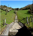
Dry Nant Melyn near Llechryd
On April 11th 2019 no surface water is visible on Nant Melyn, a tributary of the Rhymney River.
Image: © Jaggery
Taken: 11 Apr 2019
0.19 miles


