1
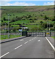
Warn's Terrace houses, Abertysswg
On the approach to the centre of the village.
Image: © Jaggery
Taken: 4 May 2019
0.01 miles
2
Warn's Terrace houses, Abertysswg
Alongside the main road through the village.
Image: © Jaggery
Taken: 4 May 2019
0.02 miles
3
Site formerly occupied by Elim Tabernacle church, Abertysswg
Viewed in May 2019. The church seen here https://www.geograph.org.uk/photo/951971 in August 2008 has gone.
Image: © Jaggery
Taken: 4 May 2019
0.02 miles
4
Elim Tabernacle
A Pentescostal church situated on the main street through Abertysswg.
Image: © Robin Drayton
Taken: 23 Aug 2008
0.02 miles
5
Bungalows below Warne's Terrace, Abertysswg
Originally, bungalow was used in English for a lightly-built house, with a veranda and one storey.
In current UK usage it is a convenient word for any one-storey dwelling.
Image: © Jaggery
Taken: 4 May 2019
0.03 miles
6
Abertysswg Working Men's Club & Institute
On the north side of Walter Street in Abertysswg.
Image: © Jaggery
Taken: 4 May 2019
0.05 miles
7
School entrance gates in Abertysswg
South of Warn's Terrace, the gates give access to the school car park
east of Idris Davies School 3-18 in the valley of the Rhymney River.
Image: © Jaggery
Taken: 4 May 2019
0.05 miles
8
Abertysswg Working Men's Club
Situated on the main street through Abertysswg. For the view taken from the left of this picture see
Image
Image: © Robin Drayton
Taken: 23 Aug 2008
0.06 miles
9
Traffic calming on the approach to Warn's Terrace, Abertysswg
Vehicles on the camera side must give way to oncoming vehicles.
The 30mph speed limit drops to 20mph.
Image: © Jaggery
Taken: 4 May 2019
0.06 miles
10
Houses in Abertysswg
Viewed from near to Duffryn Farm http://www.geograph.org.uk/photo/987905 in the valley below.
The building in the centre is Abertysswg Working Men's Club http://www.geograph.org.uk/photo/951895.
Image: © Robin Drayton
Taken: 14 May 2014
0.06 miles


