1
Ordnance Survey Cut Mark
This OS cut mark can be found on the wall north side of the road. It marks a point 328.148m above mean sea level.
Image: © Adrian Dust
Taken: 5 Dec 2020
0.05 miles
2
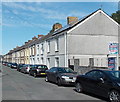
Walter Street, Tredegar
Looking NW from the edge of Arthur Street, near Bethania Chapel. http://www.geograph.org.uk/photo/3638028
Image: © Jaggery
Taken: 5 Sep 2013
0.09 miles
3
Looking over Georgetown, Tredegar
Georgetown Primary School is in the centre of the view.
Image: © Robin Drayton
Taken: 12 Mar 2014
0.09 miles
4
Ordnance Survey Cut Mark
This OS cut mark can be found on the wall north side of Woodfield Road. It marks a point 289.550m above mean sea level.
Image: © Adrian Dust
Taken: 5 Dec 2020
0.09 miles
5
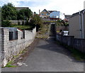
Steps on a path to Rhyd Terrace, Tredegar
Viewed along the path between Walter Street and Arthur Street.
Image: © Jaggery
Taken: 5 Sep 2013
0.09 miles
6
Walter Street, Georgetown
Image: © Ian S
Taken: 24 May 2014
0.10 miles
7
Checkpoint 9B on the Valleys 100
It's 10-30am on Sunday and after walking over 55 miles in non-stop rain in the last 24 hours this walker is composing himself for the next 45 miles. He's just had a cooked meal and a can of beer and just about to roll a cigarette. Now who said walking was good for your health?
Image: © Ian S
Taken: 25 May 2014
0.10 miles
8
Checkpoint 9B, Georgetown, Tredegar
Georgetown Community Centre is the breakfast stop on the LDWA 2014 Valleys 100.
Image: © Ian S
Taken: 25 May 2014
0.10 miles
9
Checkpoint 9B, Georgetown, Tredegar
Georgetown Community Centre is the breakfast stop on the LDWA 2014 Valleys 100.
Image: © Ian S
Taken: 25 May 2014
0.10 miles
10
Bethania Chapel, Tredegar
Viewed across Arthur Street. The nameboard shows Bethania Chapel. The date stone shows Bethania Congregational Church 1909. http://www.geograph.org.uk/photo/1188390 to another view of the chapel.
Image: © Jaggery
Taken: 5 Sep 2013
0.12 miles


