1
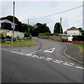
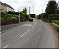
Side road, Waundeg, Tredegar
The road diverges from the road named Waundeg in the Waundeg area of Tredegar.
The road near the camera is 375 metres (1,230 ft) above mean sea level.
Image: © Jaggery
Taken: 17 Jul 2019
0.03 miles
2
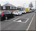
Waundeg speed bumps, Tredegar
Speed bumps/humps across the road named Waundeg in the Waundeg area of Tredegar.
Image: © Jaggery
Taken: 17 Jul 2019
0.03 miles
3
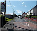
One-way signs, Waundeg, Tredegar
Alongside the road named Waundeg in the Waundeg area of Tredegar.
Image: © Jaggery
Taken: 17 Jul 2019
0.04 miles
4
Tynewydd, Tredegar
Looking to the NW along Tynewydd from Waundeg.
These roads with Welsh names do not have an English name.
Image: © Jaggery
Taken: 17 Jul 2019
0.08 miles
5
Waundeg houses opposite a green, Tredegar
Alongside the road named Waundeg in the Waundeg area of Tredegar.
Image: © Jaggery
Taken: 17 Jul 2019
0.11 miles
6
Houses behind a green, Waundeg, Tredegar
Viewed from the road named Waundeg in the Waundeg area of Tredegar.
Image: © Jaggery
Taken: 17 Jul 2019
0.11 miles
7
20 zone along Waundeg, Tredegar
The 30mph speed limit along Trefil Road behind the camera reduces to 20mph ahead.
Image: © Jaggery
Taken: 22 Aug 2013
0.13 miles
8
Traffic calming along Trefil Road opposite Tynewydd
Traffic ahead has priority over oncoming traffic past the short section of narrowed roadway.
The sign on the left shows 52-60 Tynewydd.
Image: © Jaggery
Taken: 22 Aug 2013
0.13 miles
9
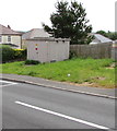
Western Power Distribution electricity substation, Waundeg, Tredegar
The grey cabinet alongside the road named Waundeg is a Western Power Distribution electricity substation.
Its identifier is TYNEWYDD DUKESTOWN S/S 551434
Image: © Jaggery
Taken: 17 Jul 2019
0.14 miles
10
Up Trefil Road, Tredegar
Trefil Road ascents towards the small village of Trefil
Image
Image: © Jaggery
Taken: 17 Jul 2019
0.14 miles


