1
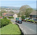
Path to a bridge across Malpas Brook, Bettws, Newport
Viewed from the edge of an open space at the western end of Livale Court.
Image: © Jaggery
Taken: 6 Jan 2011
0.04 miles
2
Path junction, Bettws, Newport
The path on the left leads to Tamar Close. The one on the right climbs to Avon Close.
Image: © Jaggery
Taken: 6 Jan 2011
0.04 miles
3
Wye Crescent houses, Bettws, Newport
Houses on the north side of the middle section of Wye Crescent. There is a river theme to the naming of many streets in Bettws.
Image: © Jaggery
Taken: 28 Apr 2011
0.04 miles
4
Wye Crescent, Bettws, Newport
Houses on the north side of Wye Crescent, viewed from the edge of a semi-open area containing much grass and a few trees.
Image: © Jaggery
Taken: 28 Apr 2011
0.04 miles
5
Open space at the west end of Livale Court, Bettws, Newport
Viewed about an hour before sunset on a dull day in early January 2011. The open space is near a brook, the upper stretch of which is named Bettws Brook and the lower stretch, Malpas Brook.
Image: © Jaggery
Taken: 6 Jan 2011
0.04 miles
6
Mound between Livale Court and Ribble Walk, Bettws, Newport
A small mound of unknown origin is located in an open space between Monnow Way and Malpas Brook. The two streets in the title are the other two boundaries of the open space.
Image: © Jaggery
Taken: 6 Jan 2011
0.04 miles
7
Path to Ribble Walk, Bettws, Newport
A path heads away from a bridge across Malpas Brook (just out of shot on the left), along the edge of an open space.
Image: © Jaggery
Taken: 6 Jan 2011
0.05 miles
8
Loden Close, Bettws
Image: © Roger Cornfoot
Taken: 1 Mar 2007
0.07 miles
9
Path through Rocky's Park, Bettws, Newport
Towards Malpas Brook. The Rocky's Park name sign https://www.geograph.org.uk/photo/5948992 is on the right.
Image: © Jaggery
Taken: 20 Aug 2018
0.08 miles
10
Towards Ribble Walk, Bettws, Newport
From the south side of Monnow Way.
Image: © Jaggery
Taken: 20 Aug 2018
0.08 miles


