1
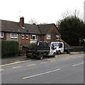
Darent Rd, Bettws
Image: © John Lord
Taken: 26 Feb 2011
0.02 miles
2
Two B & H Clearance lorries, Monnow Way, Bettws, Newport
B & H Clearance Ltd is a groundwork contractors business based in
Magdella House, Broad Street Common, Nash, Newport.
Image: © Jaggery
Taken: 29 Feb 2016
0.02 miles
3
272-282 Monnow Way, Bettws, Newport
3-storey block of flats on the east side of Monnow Way. Darent Road is on the right.
Image: © Jaggery
Taken: 29 Feb 2016
0.03 miles
4
Three-storey block of flats, Bettws, Newport
Located on the east side of Monnow Way, between Darent Close and Darent Road.
The Newport City Homes name sign on the building shows 272-282 Monnow Way (evens).
Newport City Homes (NCH) came into existence in March 2009, when Newport City Council transferred its housing stock to the new organisation. NCH provides services to more than 10,000 residents, leaseholders and shared owners in the city. NCH's central office is Nexus House, Mission Court, Newport.
Image: © Jaggery
Taken: 29 Feb 2016
0.03 miles
5
Two telecoms cabinets on a Bettws corner, Newport
The dark green boxes are on the corner of Monnow Way and Ogmore Crescent.
Image: © Jaggery
Taken: 29 Feb 2016
0.03 miles
6
Long row of houses, Darent Road, Bettws, Newport
Most of the roads in the Bettws area of Newport are named after rivers.
The River Darent http://www.geograph.org.uk/photo/2774499 is a Kentish tributary of the River Thames.
Image: © Jaggery
Taken: 29 Feb 2016
0.04 miles
7
Darent Close electricity substation, Bettws, Newport
The grey cabinet is a Western Power Distribution electricity substation,
identifier DARENT CLOSE BETTWS S/S No. 532127.
Image: © Jaggery
Taken: 29 Feb 2016
0.04 miles
8
Darent Road, Bettws, Newport
Viewed across Monnow Way. Darent Road leads to Darent Close and Monnow School.
Image: © Jaggery
Taken: 29 Feb 2016
0.04 miles
9
Monnow Way bus stops and shelters, Bettws, Newport
Located near Nidd Close. http://www.geograph.org.uk/photo/4850576
Image: © Jaggery
Taken: 29 Feb 2016
0.04 miles
10
Warning sign - School/Ysgol, Bettws, Newport
The bilingual (English/Welsh) sign is on the corner of Monnow Way and Darent Close, near Monnow School.
Image: © Jaggery
Taken: 29 Feb 2016
0.04 miles


