IMAGES TAKEN NEAR TO
Monnow Way, NEWPORT, NP20 7DN
Introduction
This page details the photographs taken nearby to Monnow Way, NP20 7DN by members of the Geograph project.
The Geograph project started in 2005 with the aim of publishing, organising and preserving representative images for every square kilometre of Great Britain, Ireland and the Isle of Man.

There are currently over 7.5m images from over14,400 individuals and you can help contribute to the project by visiting https://www.geograph.org.uk
Image Map
Images are licensed for reuse under creativecommons.org/licenses/by-sa/2.0
Notes
- Clicking on the map will re-center to the selected point.
- The higher the marker number, the further away the image location is from the centre of the postcode.
Image Listing (141 Images Found)
Images are licensed for reuse under creativecommons.org/licenses/by-sa/2.0
Image
Details
Distance
1
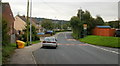
Pen-twyn Lane, Bettws, Newport
Heading towards Millbrook Junior and Infants School.
Image: © Jaggery
Taken: 31 Aug 2009
0.02 miles
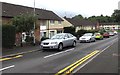
2
Parking space reserved for the vehicle of a Blue Badge holder, Monnow Way, Bettws, Newport
Painted on the road surface are DISABLED and its Welsh equivalent ANABL.
Image: © Jaggery
Taken: 20 Aug 2018
0.02 miles
3

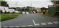
Warning sign - Patrol, Monnow Way, Bettws, Newport
Facing eastbound traffic on the approach to Millbrook Primary School.
Image: © Jaggery
Taken: 20 Aug 2018
0.02 miles
4
Pen-y-Bryn Close,Bettws
Viewed from Pen-twyn Lane.
Image: © Jaggery
Taken: 31 Aug 2009
0.05 miles
5

Pen-twyn Lane
Pen-twyn Lane heading northwestwards has lost its suburban appearance http://www.geograph.org.uk/photo/1569929 and pavement, and has narrowed into a country lane.
Image: © Jaggery
Taken: 31 Aug 2009
0.05 miles
6
Corner of Pentwyn Lane and Mill Heath, Newport
Viewed across Pentwyn Lane.
Image: © Jaggery
Taken: 5 Sep 2010
0.05 miles
7
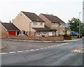
On-street parking, Livale Road, Bettws, Newport
Beyond the corner of Monnow Way where double yellow lines on both sides indicate no parking at any time.
Image: © Jaggery
Taken: 20 Aug 2018
0.05 miles
8
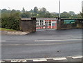
Vehicle entrance to Millbrook Primary School, Bettws
Viewed across Pentwyn Lane. This entrance, near the NW edge of the school, is for vehicles only. Pedestrians use an entrance about 70 metres to the SE, from Parret Road.
Image: © Jaggery
Taken: 5 Sep 2010
0.06 miles
9
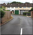
Side road south of Monnow Way, Bettws, Newport
Towards houses in Livale Court.
Image: © Jaggery
Taken: 20 Aug 2018
0.06 miles
10
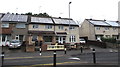
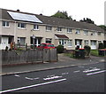
Rooftop solar panels, Monnow Way, Bettws, Newport
Ideally located on south-facing roofs.
Image: © Jaggery
Taken: 20 Aug 2018
0.06 miles