1
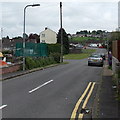
Side road to Monnow Walk, Bettws, Newport
From Monnow Way. A nearby sign pointing this way shows Monnow Walk (59-67).
Image: © Jaggery
Taken: 29 May 2014
0.03 miles
2
Monnow Way traffic calming near Clist Road, Bettws, Newport
A narrowing of the roadway and a bump are intended to slow down traffic
along the main road through Bettws. Clist Road http://www.geograph.org.uk/photo/4002216 is out of shot on the left.
Image: © Jaggery
Taken: 29 May 2014
0.04 miles
3
Monnow Way postbox, Bettws, Newport
On the corner of Cherwell Walk.
Image: © Jaggery
Taken: 29 May 2014
0.04 miles
4
Monnow Way bus stop and shelter near Clist Road, Bettws, Newport
The Bettws area of Newport currently (May 2014) has two alternating Bettws Circular services operated by Newport Bus. Both start and end in the city centre. One route is clockwise around Monnow Way, the other is counterclockwise around Monnow Way. This stop is on the clockwise service.
Image: © Jaggery
Taken: 29 May 2014
0.05 miles
5
Helford Square houses, Bettws, Newport
From the corner of Monnow Way.
Image: © Jaggery
Taken: 29 May 2014
0.05 miles
6
Solar panels on Monnow Way houses, Bettws, Newport
Near the corner of Welland Crescent. http://www.geograph.org.uk/photo/4002269
Image: © Jaggery
Taken: 29 May 2014
0.07 miles
7
Clist Walk, Bettws, Newport
Clist Walk is a 65 metres long path from Welland Crescent on this side to Clist Road ahead.
Image: © Jaggery
Taken: 29 May 2014
0.08 miles
8
Welland Crescent, Bettws, Newport
This is the NE end of Welland Crescent, viewed across Monnow Way.
Image: © Jaggery
Taken: 29 May 2014
0.09 miles
9
Clist Road, Bettws, Newport
Clist Road curves away from Monnow Way towards Welland Crescent.
Image: © Jaggery
Taken: 29 May 2014
0.09 miles
10
Bettws north of Bettws Brook, Newport
The trees are on a bank of Bettws Brook. Bettws (Betws in Welsh) is an electoral ward in the city of Newport. Formerly a sparsely-populated rural area, Bettws is now one of the largest modern housing estates in Europe.
Its population on the day of the 2011 Census was 7,606.
Image: © Jaggery
Taken: 29 Feb 2016
0.11 miles


