1
Malpas Fire Station
Malpas Fire Station, Malpas Road, Newport
Image: © Kevin Hale
Taken: 3 Jun 2007
0.01 miles
2
Fire Station, Newport
Image: © Chris Andrews
Taken: 14 Mar 2017
0.01 miles
3
Malpas Fire & Technical Rescue Station, Newport
Set back from the A4051 Malpas near M4 motorway junction 26. This is the first Fire Station in Wales to have specific Technical Rescue Watch based personnel. Part of the South Wales Fire & Rescue Service, this is one of three fire stations in the city. The others are in Duffryn http://www.geograph.org.uk/photo/1672808 and in Maindee. http://www.geograph.org.uk/photo/3283303
Image: © Jaggery
Taken: 23 Aug 2016
0.01 miles
4
No Entry signs at the edge of the Highways Depot, Malpas, Newport
The No Entry message conveyed by the standard sign on the right
is reinforced by a large No Entry sign painted on the surface of the one-way road.
Image: © Jaggery
Taken: 15 Nov 2015
0.01 miles
5
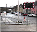
Malpas Fire Station traffic lights, Newport
The lights are off most of the time. They flash red when a vehicle needs to leave the fire station http://www.geograph.org.uk/photo/2655557 on an emergency callout. The nameboard shows that the full name of the station in January 2016 is
Malpas Fire & Technical Rescue Station, part of South Wales Fire and Rescue Service.
Image: © Jaggery
Taken: 3 Jan 2016
0.02 miles
6
Highways Malpas Depot nameboard, Newport
On the wall here. http://www.geograph.org.uk/photo/4785584
Image: © Jaggery
Taken: 3 Jan 2016
0.02 miles
7
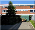
Dark green cabinet in a corner of the Ibis Budget hotel site, Newport
The cabinet is a Western Power Distribution electricity substation. The multistorey hotel https://www.geograph.org.uk/photo/6447034 is nearby.
Malpas Fire & Rescue Station is in the background.
Image: © Jaggery
Taken: 19 Apr 2020
0.02 miles
8
Entrance for Etap and Christchurch Centre
To the left is the entrance to the Christchurch Centre http://www.geograph.org.uk/photo/1502543 , to the right is the entrance to Etap hotel's car park. The M4 motorway wall is in the background.
Image: © Jaggery
Taken: 16 Aug 2009
0.03 miles
9
Training tower Malpas Fire Station, Newport
Viewed from near the entrance to the station's drill yard and industrial training unit.
The fire station http://www.geograph.org.uk/photo/467335 is located close to junction 26 of the M4 motorway.
Image: © Jaggery
Taken: 26 Feb 2010
0.03 miles
10
Fire station and hotel adjacent to M4 junction 26, Newport
Viewed from the footbridge http://www.geograph.org.uk/photo/1499965 across Malpas Road.
Malpas Fire Station is located close to junction 26 of the M4 motorway, to ensure rapid response to emergency calls. A part of the grey motorway wall can be seen next to the right edge of the Etap Hotel.
Image: © Jaggery
Taken: 2 May 2010
0.03 miles


