1
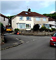
Up Graig Park Parade, Newport
From Graig Park Road, Graig Park Parade ascends northwards toward Graig Park Avenue.
Image: © Jaggery
Taken: 23 May 2020
0.01 miles
2
Corner of Graig Park Parade and Graig Park Avenue, Malpas, Newport
Houses in the Graig Park area were built in the 1930s when few people in this area owned cars.
The semi-detached houses were built without garages. The garage on the left is a later addition.
Image: © Jaggery
Taken: 1 Jan 2016
0.03 miles
3
Snowy Graig Park Parade, Newport
Viewed from Graig Park Road.
There was a snowfall ranging from 4 inches (10cm) at lower levels up to about 6 inches (15cm) at higher elevations in the city overnight January 5th/6th 2010.
Main roads were quickly cleared, but side roads, as here, remained mostly snow-covered, causing difficulties for drivers in the hillier parts of the city.
Image: © Jaggery
Taken: 8 Jan 2010
0.03 miles
4
Snowy Graig Park Lane, Newport
There was a snowfall ranging from 4 inches (10cm) at lower levels up to about 6 inches (15cm) at higher elevations in the city overnight January 5th/6th 2010.
Main roads were quickly cleared, but side roads remained mostly snow-covered, causing difficulties for drivers in the hillier parts of the city.
At a relatively low elevation (about 40 metres or 130 feet above sea level),
Graig Park Lane is only moderately affected, with a partial clearance of the roadway caused by the passage of vehicles.
Image: © Jaggery
Taken: 8 Jan 2010
0.03 miles
5
Graig Park Parade, Newport
Graig Park Parade climbs away from Graig Park Road towards Graig Park Avenue.
Houses in the Graig Park area, between Malpas Road and Graig Wood, were built c1930.
Image: © Jaggery
Taken: 1 Sep 2009
0.03 miles
6
Graig Park Parade, Newport
Viewed from the corner of Graig Park Avenue, looking towards Graig Park Road.
Image: © Jaggery
Taken: 1 Sep 2009
0.03 miles
7
Former air raid shelter, Graig Park Road, Malpas, Newport
Erected during the Second World War, at the edge of a small grassy area on the north side of Graig Park Road, between Graig Park Parade and Graig Park Villas.
The doors and windows of this single-storey building (15 metres long and 6 metres wide) are all bricked up in 2016. Although this building would be unlikely to survive a direct hit, it was a safer place to be during a bombing raid than adjacent houses. http://www.geograph.org.uk/photo/2858486 to another view.
Image: © Jaggery
Taken: 1 Jan 2016
0.04 miles
8
Path skirting school perimeter fence, Malpas
The path, which began at the edge of Graig Park Avenue, http://www.geograph.org.uk/photo/1940510 heads NW along the southern perimeter fence of Malpas Church in Wales Junior & Infants Schools.
Image: © Jaggery
Taken: 1 Sep 2009
0.04 miles
9
Waste ground, Malpas
Located on the west side of a path from Brynglas to Pillmawr Road, Malpas.
Image: © Jaggery
Taken: 1 Sep 2009
0.04 miles
10
Semis on a Graig Park corner, Newport
Semi-detached houses on the corner of Graig Park Road and Graig Park Parade.
Image: © Jaggery
Taken: 23 May 2020
0.04 miles


