1
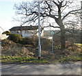
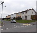
Marconi Close, Newport
Steel-framed houses on Marconi Close, viewed from the corner of Newton Way.
Marconi Close is one of three short streets connecting with Newton Way. Its two southern neighbours are Rankine Close http://www.geograph.org.uk/photo/1684699
and Boyle Close. http://www.geograph.org.uk/photo/1647657
Image: © Jaggery
Taken: 2 Jan 2010
0.03 miles
2
Rankine Close, Newport
Steel-framed houses on Rankine Close, one of three short streets connecting with Newton Way on the western edge of Malpas. Its neighbour to the south is Boyle Close http://www.geograph.org.uk/photo/1647657 and to the north, Marconi Close. http://www.geograph.org.uk/photo/1647625
On the left are solar-powered street lights.
Image: © Jaggery
Taken: 30 Jan 2010
0.04 miles
3
The Monmouthshire and Brecon Canal near Malpas
Image: © Philip Halling
Taken: 12 Apr 2013
0.05 miles
4
Newton Way, Newport
Looking west along Newton Way from Darwin Drive. The houses, like most in the area, are steel-framed. In the middle distance are solar-powered street lights.
Image: © Jaggery
Taken: 2 Jan 2010
0.06 miles
5
Steep fine for fly tipping on Newton Way, Newport
The No Tipping sign next to waste ground beside Newton Way, opposite Rankine Close, threatens a maximum fine of £20,000. I don't know if the city council has some complex scale of differential fines depending on location, or if they've recently upped the fines, but an August 2009 photo http://www.geograph.org.uk/photo/1438107 of a sign elsewhere in the city has a maximum fine of £1,000.
Image: © Jaggery
Taken: 30 Jan 2010
0.06 miles
6
Track from canal to Faraday Close, Newport
Beyond a wooden bridge http://www.geograph.org.uk/photo/2306557 across the disused Monmouthshire & Brecon canal, http://www.geograph.org.uk/photo/2343967 a track climbs towards Faraday Close.
Image: © Jaggery
Taken: 30 Jul 2010
0.06 miles
7
Partial renovation of Faraday Close, Malpas, Newport
This late February 2013 view shows that some houses (the ones with differently coloured upper and lower storeys) have been renovated and reroofed whereas others have not (yet?). http://www.geograph.org.uk/photo/1647594 to a view taken 3 years earlier.
Similar contrasts can be seen throughout this area, such as in Harvey Close. http://www.geograph.org.uk/photo/3342348
Image: © Jaggery
Taken: 22 Feb 2013
0.06 miles
8
The Monmouthshire and Brecon Canal west of Malpas
Image: © David Smith
Taken: 26 Sep 2021
0.06 miles
9
Boyle Close, Newport
Boyle Close is at the western edge of an estate of steel-framed houses. To the west is the Monmouthshire and Brecon canal, and beyond is Bettws.
Solar-powered street lights have been installed in the area : one can be seen at the left edge of the photo.
Boyle Close is one of three short streets connecting with Newton Way. Its two neighbours are Rankine Close http://www.geograph.org.uk/photo/1684699 and Marconi Close. http://www.geograph.org.uk/photo/1647625
Image: © Jaggery
Taken: 2 Jan 2010
0.07 miles
10
South side of Faraday Close, Malpas, Newport
Viewed from this path. http://www.geograph.org.uk/photo/4790524
Image: © Jaggery
Taken: 5 Jan 2016
0.07 miles


