1
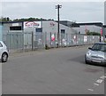
The Water House, Crindau, Newport
Set back 90 metres from the north side of Aragon Street.
The name sign on the left shows THE WATER HOUSE - BATHROOM TILE KITCHEN WAREHOUSE.
Image: © Jaggery
Taken: 9 May 2017
0.01 miles
2
Autounit, Albany Industrial Estate, Crindau, Newport
Autounit used car dealer viewed across Albany Street in April 2020.
Image: © Jaggery
Taken: 7 Apr 2020
0.01 miles
3
Empty offices , Albany Street, Newport
The 'in use 24 hours' sign at the bottom right is in stark contrast to the 'in use 0 hours' current status of the building. On Albany Street, close to the junction with The Turnstiles. Formerly occupied by Forest Traffic Management.
Image: © Jaggery
Taken: 9 Aug 2009
0.02 miles
4
Brunel Steel Services Ltd, Crindau, Newport
Located on the east side of Albany Street.
Image: © Jaggery
Taken: 1 Jan 2010
0.02 miles
5
Rear of Sainsbury's Crindau superstore, Newport
Looking along Albany Street towards central Newport. For several decades, the site now occupied by the superstore was a derelict, overgrown field with a few relics here and there of its former use as a gas company site. A photo from this spot a year ago would have shown the perimeter fence of the field, where the edge of the superstore is now.
Image: © Jaggery
Taken: 22 Sep 2010
0.02 miles
6
Entrance to delivery area, Sainsbury's Crindau, Newport
Viewed across Albany Street. A wooden fence and gate are at the entrance to area at the west side of the superstore where delivery lorries http://www.geograph.org.uk/photo/2078593 unload. Quiet at the time of this photo, this area would have been very busy in the days leading up to the opening of the store on September 22nd 2010 http://www.geograph.org.uk/photo/2077499 as stock arrived to fill up the empty shelves of a newly-built superstore.
Image: © Jaggery
Taken: 13 Oct 2010
0.02 miles
7
Right Cars Online, Crindau, Newport
Used cars dealership viewed across Albany Street from the corner of Alderney Street.
Image: © Jaggery
Taken: 9 May 2017
0.02 miles
8
West side of the Water House, 5 Aragon Street, Crindau, Newport
Viewed from the Sainsbury's superstore site. Text in view in July 2018 includes
DESIGN SERVICE - INSTALLATION - BATHROOM - KITCHEN - TILE & STONE - WET ROOM.
Image: © Jaggery
Taken: 17 Jul 2018
0.02 miles
9
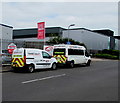
Two Highway Maintenance vans in Albany Street, Crindau, Newport
Both vans are part of the Thames Valley Construction & Civil Engineering Ltd fleet.
The Thames Valley office http://www.geograph.org.uk/photo/4094423 is nearby.
Image: © Jaggery
Taken: 9 May 2017
0.03 miles
10
Albany Street electricity substation near Right Cars, Crindau, Newport
On the left, the dark green cabinet behind the fence is a Western Power Distribution electricity substation.
Its identifier is ALBANY STREET NEWPORT S/S No. 53-6850.
Image: © Jaggery
Taken: 9 May 2017
0.03 miles


