1
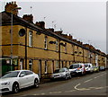
West side of Hoskins Street, Crindau, Newport
Looking north from Pugsley Street.
Image: © Jaggery
Taken: 17 Apr 2018
0.01 miles
2
Crindau mural, Newport
Mural on a wall at the corner of Wheeler Street and Evans Street, viewed from the edge of Shaftesbury Park. http://www.geograph.org.uk/photo/1638034 to a closeup of the mural.
Image: © Jaggery
Taken: 28 Dec 2009
0.01 miles
3
Crindau mural detail
Closeup view of the Crindau mural. http://www.geograph.org.uk/photo/1638013
Image: © Jaggery
Taken: 28 Dec 2009
0.01 miles
4
Hoskins Street, Newport
The view north from the corner of Evans Street.
This area was developed in the 1880s. At about the time that Hoskins Street was being built, the mayor of Newport (1886) was George Hoskins. Nearby is Pugsley Street. George Pugsley was mayor of Newport in 1887. Charles Lyne was mayor in 1884 and Lyne Street is also nearby. There may be a pattern here...
Image: © Jaggery
Taken: 4 Sep 2009
0.01 miles
5
Shaftesbury Community Centre, Newport
On the corner of Hoskins Street and Evans Street.
A long line of black anti-intruder devices can be seen about 3 metres above street level.
Image: © Jaggery
Taken: 4 Sep 2009
0.01 miles
6
Wheeler Street, Crindau, Newport
Christmas Day 2010. Snow persists after a moderate fall five days earlier. Looking towards Evans Street along Wheeler Street from the corner of Pugsley Street.
Image: © Jaggery
Taken: 25 Dec 2010
0.01 miles
7
Residents only parking area, Ledbury Drive, Newport
Between Malmesbury Close and Glastonbury Close, the blue notice on the wall shows
RESIDENTS PARKING ONLY.
Image: © Jaggery
Taken: 15 Nov 2015
0.02 miles
8
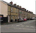
Long row of houses, Hoskins Street, Newport
Viewed across Evans Street. The row of houses extends for 80 metres along the east side of Hoskins Street.
Image: © Jaggery
Taken: 17 Apr 2018
0.02 miles
9
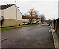
North along Ledbury Drive, Crindau, Newport
Extending for 250 metres, Ledbury Drive is a connecting road on the east side of several cul-de-sacs.
Viewed from near Shrewsbury Close, http://www.geograph.org.uk/photo/4744231 one of the cul-de-sacs
Image: © Jaggery
Taken: 15 Nov 2015
0.03 miles
10
Middle part of Shaftesbury Walk, Newport
Shaftesbury Walk extends from Wyndham Street to Evans Street (out of shot ahead).
Image: © Jaggery
Taken: 5 May 2022
0.03 miles


