1
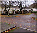
Middle part of Shaftesbury Walk, Newport
Shaftesbury Walk extends from Wyndham Street to Evans Street (out of shot ahead).
Image: © Jaggery
Taken: 5 May 2022
0.01 miles
2
Residents only parking area, Ledbury Drive, Newport
Between Malmesbury Close and Glastonbury Close, the blue notice on the wall shows
RESIDENTS PARKING ONLY.
Image: © Jaggery
Taken: 15 Nov 2015
0.03 miles
3
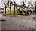
Shrewsbury Close, Crindau, Newport
Viewed across Ledbury Drive.
Image: © Jaggery
Taken: 15 Nov 2015
0.03 miles
4
Glastonbury Close houses, Newport
Viewed across Ledbury Drive.
Image: © Jaggery
Taken: 15 Nov 2015
0.03 miles
5
Malmesbury Close, Crindau, Newport
On the west side of Ledbury Drive.
Image: © Jaggery
Taken: 15 Nov 2015
0.03 miles
6
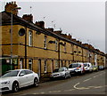
West side of Hoskins Street, Crindau, Newport
Looking north from Pugsley Street.
Image: © Jaggery
Taken: 17 Apr 2018
0.03 miles
7
Pugsley Street, Crindau, Newport
Viewed from the corner of Evans Street. There are houses on only one side of the street. The other side is the edge of allotments. http://www.geograph.org.uk/photo/1638042
Image: © Jaggery
Taken: 13 Jul 2011
0.04 miles
8
Shaftesbury Methodist Church, Newport
Located in Shaftesbury Street, between Malpas Road and the city centre.
In addition to religious services, the church is where the local U3A (University of the Third Age) meet, currently (January 2013) from 10am to 3.30pm each Wednesday, Thursday and Friday.
Image: © Jaggery
Taken: 27 Jan 2013
0.04 miles
9
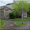
Rear of Shaftesbury Methodist Church, Newport
Viewed from Shaftesbury Walk. The church is in use as a polling station https://www.geograph.org.uk/photo/7168671 today, Thursday May 5th 2022.
Image: © Jaggery
Taken: 5 May 2022
0.04 miles
10
Path from Pugsley Street to Canterbury Close, Newport
In the Shaftesbury area of Newport.
Image: © Jaggery
Taken: 5 May 2022
0.04 miles


