1
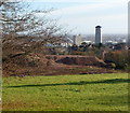
Allt-yr-yn campus, University of Wales, Newport
Viewed from the top of Newport Cathedral tower http://www.geograph.org.uk/photo/716275 .
Image: © Robin Drayton
Taken: 4 Jul 2011
0.04 miles
2
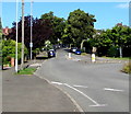
Allt-yr-yn Avenue houses, Newport
Houses on the SW side of the street, roughly midway between the turning for Allt-yr-yn Close, behind the camera, and the college entrance road ahead. http://www.geograph.org.uk/photo/1981050
Image: © Jaggery
Taken: 25 Jul 2010
0.05 miles
3
Allt-yr-yn Avenue houses, Newport
Viewed from the corner of Allt-yr-yn Close.
Image: © Jaggery
Taken: 25 Jul 2010
0.05 miles
4
Site of former Allt-yr-yn Campus, Newport
Viewed from Allt-yr-yn Avenue through the edge of the fenced-off building site.
The Allt-yr-yn Campus http://www.geograph.org.uk/photo/1981053 became redundant when the City Centre campus http://www.geograph.org.uk/photo/1886472 of the University of Wales, Newport opened in 2011. The campus buildings have been demolished, replaced for now by large mounds of earth. Housing is to be built on this site.
Image: © Jaggery
Taken: 23 Nov 2012
0.05 miles
5
Ordnance Survey Cut Mark
This OS cut mark can be found on No43 Allt Yr Yn Avenue. It marks a point 53.127m above mean sea level.
Image: © Adrian Dust
Taken: 17 Jun 2018
0.08 miles
6
Up Allt-yr-yn Avenue, Newport
Allt-yr-yn Avenue ascends away from this http://www.geograph.org.uk/photo/5080306 roundabout, an edge of which is on the right.
Image: © Jaggery
Taken: 17 Aug 2016
0.09 miles
7
Allt-yr-yn Road, Newport
The view from the junction with Allt-yr-yn Avenue
Image: © Jaggery
Taken: 10 Dec 2009
0.09 miles
8
Allt-yr-yn Avenue, Newport
Looking up Allt-yr-yn Avenue from the roundabout at the junction with Allt-yr-yn Road. The entrance to the University of Wales, Newport campus at Allt-yr-yn is several hundred metres away, beyond the bend at the top of the view.
At the risk of offending Welsh language purists, but with the intention of helping visitors to the area, I'll mention that the local pronunciation of Allt-yr-yn is "alter-een".
Image: © Jaggery
Taken: 10 Dec 2009
0.09 miles
9
Allt-yr-yn Close, Newport
Presumably a cul-de-sac when built in the 1930s, 'Close' is no longer a correct description of this road. The view here is from the edge of Allt-yr-yn Avenue. The far end of the Close connects with Allt-yr-yn Road, adjacent to the Highcroft Road junction.
Image: © Jaggery
Taken: 10 Dec 2009
0.09 miles
10
Ordnance Survey Cut Mark
This OS cut mark can be found on No26 Allt Yr Yn Avenue. It marks a point 66.456m above mean sea level.
Image: © Adrian Dust
Taken: 17 Jun 2018
0.10 miles


