1
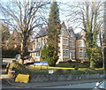
Tredegar Constitutional Club, Newport
Located on the corner of Oakfield Road and Parkfield Place.
Image: © Jaggery
Taken: 2 Mar 2011
0.04 miles
2
Newport Civic Centre entrance number 4
Viewed across Clytha Park Road. The date on the building is in Roman numerals, MCMXXXIX (1939).
The Grade II* list Civic Centre was commissioned by Newport Corporation in 1936. The first sod was cut by King George VI and Queen Elizabeth on July 4th 1937. The shell of the building was largely complete and partly in use by 1939, though it was another 25 years before the work was finished, with the completion of the central entrance hall, stair and tower in 1964. During the Second World War, uncompleted parts had been roofed over and used by the Admiralty.
Image: © Jaggery
Taken: 2 Mar 2011
0.05 miles
3
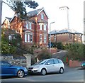
Houses at the eastern end of Oakfield Road, Newport
The houses are near the corner of Clytha Park Road. The ghostly white structure in the background is the Civic Centre clock tower http://www.geograph.org.uk/photo/2198118 bathed in early spring sunshine.
Image: © Jaggery
Taken: 2 Mar 2011
0.05 miles
4
Edward VII Garage
Junction of Edward VII Crescent and Westfield Road. A small workshop situated in an area of large, detached, Victorian houses.
Image: © Robin Drayton
Taken: 18 Dec 2009
0.05 miles
5
Aragon House, Oakfield Road, Newport
Three-storey building, near the eastern end of Oakfield Road, containing 14 flats.
Image: © Jaggery
Taken: 2 Mar 2011
0.06 miles
6
Clytha Park
Image: © Paula Rogers
Taken: 27 Jan 2007
0.06 miles
7
Burleigh Road and Hilla Road, Newport
Viewed from Llanthewy Road looking down Burleigh Road, across Bryngwyn Road, then along Hilla Road towards Oakfield Road. Iglesia Ni Cristo http://www.geograph.org.uk/photo/3765471 is on the left.
Image: © Jaggery
Taken: 2 Dec 2013
0.07 miles
8
Ordnance Survey Cut Mark
This OS cut mark can be found on the wall SE side of Fields Road. It marks a point 54.964m above mean sea level.
Image: © Adrian Dust
Taken: 17 Jun 2018
0.08 miles
9
Fields Road, Newport
Image: © Robin Drayton
Taken: 15 Sep 2008
0.09 miles
10
Fields Park Road houses, Newport
Houses on the south side of Fields Park Road, east of Fields Park Crescent are overtowered by the 55 metre (180 feet) high Civic Centre clock tower. http://www.geograph.org.uk/photo/969665
Image: © Jaggery
Taken: 25 Jul 2010
0.09 miles


