1
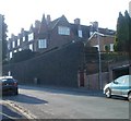
Southern end of Oakfield Road, Newport
Viewed across Risca Road.
Image: © Jaggery
Taken: 19 Mar 2016
0.01 miles
2
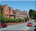
Houses near the top end of Oakfield Road, Newport
Houses on the north side of Oakfield Road viewed from the corner of Ivy Road.
Beyond the row of four houses nearest the camera is the right turn into Tyllwyd Road. At the left edge of the view is Clewer Court.
Image: © Jaggery
Taken: 2 Mar 2011
0.02 miles
3
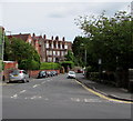
Clewer Court, Newport
Located at the top (Risca Road) end of Oakfield Road. Built as an orphanage in 1906, Clewer Court was converted into flats several decades ago, certainly before the mid 1960s. The flats are numbered 1-12, 12a, 14-24. The numbering 12a appears to be an example of triskaidekaphobia.
Image: © Jaggery
Taken: 2 Mar 2011
0.02 miles
4
SE corner of Clewer Court, Newport
The view up Oakfield Road towards Clewer Court, http://www.geograph.org.uk/photo/2291612 a large building now converted into flats.
Image: © Jaggery
Taken: 2 Mar 2011
0.02 miles
5
The Vicarage and Clewer Court, Newport
Located at the top (southern) end of Oakfield Road.
On the left is the vicarage for St John the Baptist's church http://www.geograph.org.uk/photo/2523056 located nearby.
On the right is the southern edge of Clewer Court http://www.geograph.org.uk/photo/2291612 built as an orphanage, but converted to flats several decades ago.
Image: © Jaggery
Taken: 26 Jul 2011
0.02 miles
6
Oakfield Road, Newport
The southern end of Oakfield Road viewed across Risca Road. A bus stop is on the right.
Image: © Jaggery
Taken: 26 Jun 2017
0.02 miles
7
Oakfield Road, Newport
The southern end of Oakfield Road viewed across Risca Road on March 19th 2018.
Traces of the light snowfall overnight on the 17th-18th are on the wall on the right.
Image: © Jaggery
Taken: 19 Mar 2018
0.02 miles
8
Stone calvary, Oakfield Road, Newport
Located here, http://www.geograph.org.uk/photo/4872188 in the northwest corner of the churchyard of the Parish Church
of St John the Baptist. A calvary is a depiction of the crucifixion of Jesus Christ.
Image: © Jaggery
Taken: 19 Mar 2016
0.02 miles
9
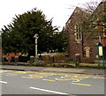
Oakfield Road bus stop, Newport
For buses from the city centre on routes towards Risca.
A stone calvary http://www.geograph.org.uk/photo/4872182 is in the background.
Image: © Jaggery
Taken: 19 Mar 2016
0.03 miles
10
West side of the Parish Church of St John the Baptist, Newport
Viewed from Oakfield Road. The church http://www.geograph.org.uk/photo/4872151 is part of the Church in Wales Diocese of Monmouth.
Image: © Jaggery
Taken: 19 Mar 2016
0.03 miles


