1
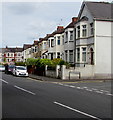
Snow remnants, Risca Road, Newport
On March 19th 2018, remnants of the light snowfall overnight
on the 17th-18th remain on roofs and on the pavement on the right.
The houses are between Preston Avenue (on the left) and Penllyn Avenue.
Image: © Jaggery
Taken: 19 Mar 2018
0.01 miles
2
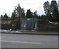
Penllyn Avenue electricity substation, Newport
The Western Power Distribution electricity substation, identifier PENLLYN AVE. NPT. S/S 532459, is on the south side of Risca Road in a gap in the perimeter wall of St Woolos Cemetery near the corner of Penllyn Avenue.
Image: © Jaggery
Taken: 19 Mar 2018
0.02 miles
3
Row of houses, Risca Road, Newport
Extending for 55 metres on the north side of Risca Road between Penllyn Avenue and Preston Avenue.
Image: © Jaggery
Taken: 26 Jun 2017
0.02 miles
4
Southwest end of Preston Avenue, Newport
From Risca Road along Preston Avenue towards Edward VII Avenue. On March 19th 2018,
remnants of the light snowfall overnight on the 17th-18th remain on roofs on the left and some car windows.
Image: © Jaggery
Taken: 19 Mar 2018
0.02 miles
5
Risca Road houses, Newport
A row of houses facing St Woolos Cemetery. Viewed from opposite the Preston Avenue http://www.geograph.org.uk/photo/2522772 junction, looking towards the left turn into Penllyn Avenue.
Image: © Jaggery
Taken: 26 Jul 2011
0.02 miles
6
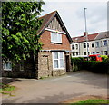
Former cemetery lodge, Risca Road, Newport
Viewed across Risca Road from Penllyn Avenue. Now a private dwelling, the building was formerly the St Woolos Cemetery lodge on the north side of the cemetery.
Image: © Jaggery
Taken: 26 Jul 2011
0.02 miles
7
Risca Road house on the corner of Penllyn Avenue, Newport
Viewed across Risca Road. Penllyn Avenue houses http://www.geograph.org.uk/photo/2522837 start on the right, just beyond the red car.
Image: © Jaggery
Taken: 26 Jul 2011
0.02 miles
8
Former cemetery lodge, Risca Road, Newport
Viewed from the northern edge of St Woolos Cemetery. Now a private dwelling,
the building was formerly the St Woolos Cemetery lodge at the entrance http://www.geograph.org.uk/photo/5441538 opposite Penllyn Avenue.
Image: © Jaggery
Taken: 26 Jun 2017
0.02 miles
9
An entrance to St Woolos Cemetery, Newport
One of several cemetery entrances, this one is from Risca Road opposite Penllyn Avenue.
Image: © Jaggery
Taken: 26 Jun 2017
0.03 miles
10
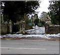
Risca Road entrance to St Woolos Cemetery, Newport
One of several entrances to St Woolos Cemetery, this one is from Risca Road opposite Penllyn Avenue.
On March 19th 2018, much of the light snowfall overnight on the 17th-18th
remains in the cemetery whereas most of the snow has gone from this side.
Image: © Jaggery
Taken: 19 Mar 2018
0.03 miles


