1
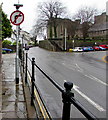
No Right Turn sign, Stow Hill, Newport
On the approach to the junction with one-way Clifton Road.
Image: © Jaggery
Taken: 19 Mar 2020
0.02 miles
2
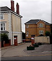
A view from the top of Park Square Multi-Storey Car Park [1]
The houses shown in side view are in Park Square.
The pair of houses facing are in Victoria Road and behind these is the rear of properties in Stow Hill.
Above the trees is
Image
Image: © Robin Drayton
Taken: 1 Jun 2009
0.02 miles
3
Benchmark on wall outside #81 Stow Hill
Ordnance Survey cut mark benchmark which is described on the Bench Mark Database at http://www.bench-marks.org.uk/bm35077.
Image: © Roger Templeman
Taken: 5 Aug 2010
0.02 miles
4
Ordnance Survey Cut Mark
This OS cut mark can be found on the wall of No81 Stow Hill. It marks a point 44.431m above mean sea level.
Image: © Adrian Dust
Taken: 9 Jun 2018
0.02 miles
5
Entrance to Kingshill Court, Stow Hill, Newport
Kingshill Court apartments are set back from the east side of Stow Hill, opposite the Clifton Road junction.
Image: © Jaggery
Taken: 18 Jul 2014
0.02 miles
6
Entrance to Kingshill Court and to The Orchards, Newport
From the east side of Stow Hill. The Kingshill Court entrance is on the left.
Image: © Jaggery
Taken: 19 Mar 2020
0.02 miles
7
Queen Victoria Memorial Almshouses, Stow Hill, Newport
The southwest corner of the Grade II listed almshouses in an elevated position on the west side of Stow Hill, to the north of the cathedral. Text on the pediment is QUEEN VICTORIA MEMORIAL AD 1901. The group of nine buildings, aligned along three sides of a rectangle, was built in 1901, probably replacing much earlier almshouses.
Image: © Jaggery
Taken: 14 May 2018
0.03 miles
8
Victoria Close, Newport
4 residential properties in Victoria Close, adjoining Victoria Place.
Image: © Jaggery
Taken: 16 Nov 2009
0.03 miles
9
Northern side of Victoria Place, Newport
One of two opposing terraces http://www.geograph.org.uk/photo/4085836 built c1840. Restored in 1977, both terraces are Grade II listed.
Viewed from the elevated pavement on the west side of Stow Hill.
Image: © Jaggery
Taken: 13 Jun 2010
0.03 miles
10
Stow Passage, Newport
A narrow arch on the left side of 82 Stow Hill leads to a narrow (1 metre wide) passageway to a lane from the corner of Jones Street and North Street.
Image: © Jaggery
Taken: 13 Jun 2010
0.03 miles


![A view from the top of Park Square Multi-Storey Car Park [1]](https://s2.geograph.org.uk/geophotos/01/35/01/1350146_1e7b5162_120x120.jpg)


