1
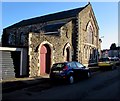
Victoria Crescent , Baneswell, Newport
Viewed from Blewitt Street looking towards West Street.
Image: © Jaggery
Taken: 16 Nov 2009
0.01 miles
2
Blewitt Street, Baneswell, Newport
The view from the St Mary Street end of Blewitt Street looking towards East Street.
Image: © Jaggery
Taken: 16 Nov 2009
0.01 miles
3
West Street, Baneswell, Newport
The view northwards from St Mary Street.
Image: © Jaggery
Taken: 16 Nov 2009
0.01 miles
4
Bailey Street, Baneswell, Newport
Looking northwards from the edge of Victoria Crescent towards shops in Baneswell Road.
Image: © Jaggery
Taken: 16 Nov 2009
0.01 miles
5
Blewitt Street, Baneswell, Newport
Blewitt Street ascends for 220 metres from East Street to Clyffard Crescent and St Mary Street.
The sign on the right, a white arrow on a blue background, shows direction of travel on a one-way street.
Image: © Jaggery
Taken: 15 Nov 2015
0.03 miles
6
St Mary Street Baptist Church, Newport
Located near the junction with St Edward Street, this church has been a landmark in the Baneswell area of Newport for more than a century. St Mary Street Baptist Church is part of the South Wales Baptist Association which was formed in 2001 when the three Associations of the South Wales Group merged. It is part of the Baptist Union of Great Britain and works closely with the Baptist Union of Wales.
Image: © Jaggery
Taken: 21 Nov 2015
0.03 miles
7
Pillarbox and church, St Mary Street, Baneswell, Newport
The 20th century Elizabethan pillarbox is on the corner of St Edward Street,
in front of St Mary Street Baptist Church.
Image: © Jaggery
Taken: 21 Nov 2015
0.03 miles
8
St Mary Street Baptist Church
Church in Newport, South Wales.
Image: © Wayland Smith
Taken: 6 Apr 2013
0.03 miles
9
Benchmark on St Mary Street Baptist Church
Ordnance Survey cut mark benchmark which is described on the Bench Mark Database at http://www.bench-marks.org.uk/bm35081.
Image: © Roger Templeman
Taken: 5 Aug 2010
0.03 miles
10
Ordnance Survey Cut Mark
This OS cut mark can be found on the front of St Mary's Baptist Church. It marks a point 34.254m above mean sea level.
Image: © Adrian Dust
Taken: 17 Jun 2018
0.03 miles


