1
Freight train heads west at Gaer Junction
After leaving Newport station and heading through the tunnels one passes Gaer Junction where the line diverges towards Park junction . Straight on will take you towards Alexander Dock Junction and the South Wales main line towards Cardiff .This freight train is heading for the yard at Alexander dock Junction
Image: © roger geach
Taken: 30 Jul 1993
0.05 miles
2
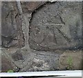
Ordnance Survey Cut Mark
This OS cut mark can be found on The Cottage, Stow Park Avenue. It marks a point 60.059m above mean sea level.
Image: © Adrian Dust
Taken: 17 Jun 2018
0.06 miles
3
Stow Park Drive
Image: © Robin Drayton
Taken: 23 Jan 2009
0.06 miles
4
Stow Park Drive, Newport
Houses on the south side of Stow Park Drive, a cul-de-sac on the west side of Stow Park Avenue.
The houses were built c1995.
Image: © Jaggery
Taken: 13 Aug 2011
0.06 miles
5
Ordnance Survey Cut Mark
This OS cut mark can be found on No5 Stow Park Avenue. It marks a point 50.781m above mean sea level.
Image: © Adrian Dust
Taken: 9 Jun 2018
0.06 miles
6
Stow Park Avenue
Image: © Robin Drayton
Taken: 23 Jan 2009
0.07 miles
7
Princess Elizabeth leaves Newport
LMS locomotive 6201 Princess Elizabeth leaves the tunnels at Newport, heading an excursion to Swansea.
Image: © Gareth James
Taken: 19 Jun 2010
0.07 miles
8
Burton Alms Houses, Newport
On Friars Road. http://www.geograph.org.uk/photo/1472553 to a view of the other half of the Alms Houses, which continue beyond the left edge of the photo
Image: © Jaggery
Taken: 13 Aug 2009
0.08 miles
9
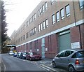
Springfield Day Hospital, St Woolos, Newport
Springfield Day Hospital (entrance at the far end of the road) is part of the Casnewydd Unit, St Woolos Hospital. It is located near the southern entrance http://www.geograph.org.uk/photo/1473698 to St Woolos.
Image: © Jaggery
Taken: 6 Mar 2011
0.08 miles
10
Southern entrance road to St Woolos Hospital, Newport
A road http://www.geograph.org.uk/photo/1473698 from Friars Road leads to the entrance, on the left, into the newer southern section of the hospital. An enclosed bridge, visible in the background, connects to the older northern part of the hospital. The white cylinders contain oxygen.
Image: © Jaggery
Taken: 23 Jan 2011
0.08 miles


