1
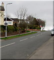
Tree-lined Melbourne Way, Newport
Melbourne Way descends towards Western Avenue past the Montreal Close junction http://www.geograph.org.uk/photo/5315400 on the right.
Image: © Jaggery
Taken: 17 Mar 2017
0.01 miles
2
Your Speed indicator facing Melbourne Way, Newport
Apparently showing 188, but actually off at the moment. When a vehicle approaches, the indicator is illuminated to display its speed, in green numbers if within the speed limit, in red numbers if higher.
Image: © Jaggery
Taken: 17 Mar 2017
0.02 miles
3
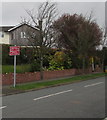
New Road Layout Ahead sign, Melbourne Way, Newport
The bilingual (English/Welsh) red sign faces Melbourne Way on the approach to Glasllwch Primary School.
Image: © Jaggery
Taken: 17 Mar 2017
0.02 miles
4
Looking towards the north from Gaer Fort
The Glasllwch area of Newport is in the middle distance.
Mynydd Henllys https://www.geograph.org.uk/gridref/ST2594 is on the horizon.
Image: © Robin Drayton
Taken: 20 Apr 2020
0.03 miles
5
R3 bus ascends Melbourne Way, Newport
The NAT (New Adventure Travel) bus is on route R3 to Market Square bus station in Newport city centre.
Image: © Jaggery
Taken: 17 Mar 2017
0.04 miles
6
Up Melbourne Way, Newport
Melbourne Way ascends towards the Toronto Close junction. http://www.geograph.org.uk/photo/5315395
Image: © Jaggery
Taken: 17 Mar 2017
0.04 miles
7
Montreal Close, Newport
Cul-de-sac on the northwest side of Melbourne Way.
Image: © Jaggery
Taken: 17 Mar 2017
0.04 miles
8
Vancouver Drive houses NE of Wellington Road, Newport
Viewed from near the Wellington Road http://www.geograph.org.uk/photo/3154395 junction.
Image: © Jaggery
Taken: 29 Sep 2012
0.04 miles
9
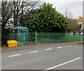
Melbourne Way electricity substation , Newport
The dark green cabinet is a Western Power Distribution electricity substation, identifier S/S 53-1240, located at the edge of Glasllwch Primary School.
Image: © Jaggery
Taken: 17 Mar 2017
0.05 miles
10
A view down Vancouver Drive, Newport
Viewed from the edge of a path http://www.geograph.org.uk/photo/3154760 to a recreation area and nature reserve.
Image: © Jaggery
Taken: 29 Sep 2012
0.05 miles


