1
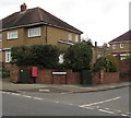
Corner of Western Avenue and Vancouver Drive, Newport
Viewed across Western Avenue. A red drop box is between telecoms cabinets.
Image: © Jaggery
Taken: 17 Mar 2017
0.01 miles
2
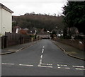
Corner of Western Avenue and Vancouver Drive, Newport
Viewed across Western Avenue.
Vancouver Drive on the right extends for nearly 600 metres, ending at the Canberra Crescent junction.
Image: © Jaggery
Taken: 29 Sep 2012
0.01 miles
3
Western Avenue bus stop, Newport
On the east side of Western Avenue, between the Vancouver Drive junction and the Melbourne Way junction.
In March 2017, this stop is on bus route R3 from Morrisons in Rogerstone to Market Square bus station Newport.
Image: © Jaggery
Taken: 17 Mar 2017
0.02 miles
4
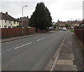
Western Avenue houses, Newport
Houses on the west side of Western Avenue between Vancouver Drive and Melbourne Way (ahead).
Image: © Jaggery
Taken: 29 Sep 2012
0.03 miles
5
Auckland Road, Newport
Auckland Road descends from Melbourne Way to Vancouver Drive.
Image: © Jaggery
Taken: 17 Mar 2017
0.04 miles
6
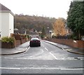
Vancouver Drive, Newport
Vancouver Drive ascends from Western Avenue. A dark green telecoms cabinet is on the left.
Image: © Jaggery
Taken: 17 Mar 2017
0.04 miles
7
Wellington Road, Newport
Viewed across Melbourne Way looking in the direction of Vancouver Drive.
Image: © Jaggery
Taken: 18 Nov 2010
0.05 miles
8
Western Avenue bus stop, Newport
On the west side of Western Avenue, between the Vancouver Drive junction and the Melbourne Way junction.
In March 2017, this stop is on bus route R3 from Market Square bus station Newport to Morrisons in Rogerstone.
Image: © Jaggery
Taken: 17 Mar 2017
0.05 miles
9
North along Western Avenue, Newport
Western Avenue extends for nearly 800 metres from Bassaleg Road (behind the camera) to the B4591.
Image: © Jaggery
Taken: 17 Mar 2017
0.06 miles
10
Auckland Road, Newport
Viewed across Melbourne Way looking in the direction of Vancouver Drive.
Image: © Jaggery
Taken: 18 Nov 2010
0.06 miles


