1
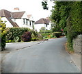
Glasllwch Lane houses, Newport
Many of the houses on Glasllwch Lane are set well back from the roadway, and shielded from it by hedges or other vegetation. These houses are an exception, in plain view at a bend in the lane near its NE end.
Image: © Jaggery
Taken: 21 Jul 2011
0.08 miles
2
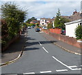
Toronto Close, Newport
Cul-de-sac viewed from Melbourne Way.
Image: © Jaggery
Taken: 17 Mar 2017
0.09 miles
3
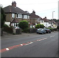
Montreal Close, Newport
Viewed across Melbourne Way.
Image: © Jaggery
Taken: 18 Nov 2010
0.10 miles
4
Quebec Close, Newport
Cul-de-sac ascending from Melbourne Way.
Image: © Jaggery
Taken: 17 Mar 2017
0.11 miles
5
Montreal Close, Newport
Cul-de-sac on the northwest side of Melbourne Way.
Image: © Jaggery
Taken: 17 Mar 2017
0.12 miles
6
Glasllwch Crescent, B4591, Newport
The view west in the direction of junction 27, M4 motorway. The B4591 has several local names hereabouts. A few hundred metres behind the camera it is Risca Road. Soon after crossing above the M4, it is High Cross Road.
Image: © Jaggery
Taken: 21 Jul 2011
0.12 miles
7
Wellington Road, Newport
Wellington Road climbs away from Vancouver Drive towards Melbourne Way, 130 metres ahead.
Image: © Jaggery
Taken: 29 Sep 2012
0.12 miles
8
Looking towards the north from Gaer Fort
The Glasllwch area of Newport is in the middle distance.
Mynydd Henllys https://www.geograph.org.uk/gridref/ST2594 is on the horizon.
Image: © Robin Drayton
Taken: 20 Apr 2020
0.12 miles
9
South side of Glasllwch Crescent, Newport
Semi-detached houses on the south side of the B4591 Glasllwch Crescent.
Ahead for M4 motorway junction 27.
Image: © Jaggery
Taken: 26 Jun 2019
0.13 miles
10
Northern end of Western Avenue, Newport
The view south along Western Avenue from the corner of Glasllwch Crescent.
The white letters on the road surface instruct drivers leaving Western Avenue to turn left. The message is reinforced by a pair of no right turn signs, out of shot behind the camera.
Image: © Jaggery
Taken: 18 Nov 2010
0.13 miles


