IMAGES TAKEN NEAR TO
Bassaleg Road, NEWPORT, NP20 3NB
Introduction
This page details the photographs taken nearby to Bassaleg Road, NP20 3NB by members of the Geograph project.
The Geograph project started in 2005 with the aim of publishing, organising and preserving representative images for every square kilometre of Great Britain, Ireland and the Isle of Man.

There are currently over 7.5m images from over14,400 individuals and you can help contribute to the project by visiting https://www.geograph.org.uk
Image Map
Images are licensed for reuse under creativecommons.org/licenses/by-sa/2.0
Notes
- Clicking on the map will re-center to the selected point.
- The higher the marker number, the further away the image location is from the centre of the postcode.
Image Listing (208 Images Found)
Images are licensed for reuse under creativecommons.org/licenses/by-sa/2.0
Image
Details
Distance
1
Gaer Park Lane, Newport
Gaer Park Lane ascends from Bassaleg Road into the Gaer area of Newport.
Image: © Jaggery
Taken: 17 Mar 2017
0.02 miles
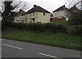
2
Cemetery perimeter railings, Bassaleg Road, Newport
The railings are at the southwest edge of St Woolos Cemetery.
Image: © Jaggery
Taken: 17 Mar 2017
0.03 miles
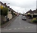
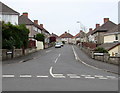
3
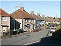
Houses and cars, Bassaleg Road, Newport
Set above the south side of Bassaleg Road, west of the Gaer Park Drive junction,
the houses face the perimeter wall of St Woolos Cemetery.
Image: © Jaggery
Taken: 19 Mar 2016
0.03 miles
4
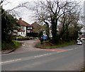
Side road to Bassaleg Road houses, Newport
The side road leads to houses set back from the south side of Bassaleg Road.
The blue sign shows Traffic Calming Ahead.
Image: © Jaggery
Taken: 17 Mar 2017
0.04 miles
5
Gaer Park Avenue houses, Newport
Houses on the NW side on the avenue, viewed from the corner of Gaer Park Hill.
Image: © Jaggery
Taken: 10 Nov 2010
0.04 miles
6
Gaer Park Lane, Newport
Houses on the NW side of Gaer Park Lane, viewed from the corner of Gaer Park Hill.
The bus in the distance is on Bassaleg Road.
Image: © Jaggery
Taken: 10 Nov 2010
0.04 miles
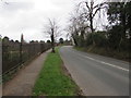
7
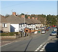
West along Bassaleg Road, Newport
Towards Bassaleg from the Gaer Park Drive junction.
Image: © Jaggery
Taken: 6 May 2016
0.04 miles
8
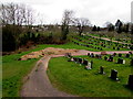
Southwest corner of St Woolos Cemetery, Newport
Viewed through the Bassaleg Road perimeter fence. St Woolos Cemetery extends for about 750 metres west to east and 420 metres south to north.
Image: © Jaggery
Taken: 17 Mar 2017
0.05 miles
9
West along Gaer Park Avenue, Newport
Viewed across Gaer Park Drive.
Image: © Jaggery
Taken: 6 May 2016
0.06 miles
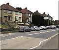
10
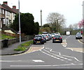
Houses aligned at right angles above Bassaleg Road, Newport
Bassaleg Road houses are on the left. Houses at the northern end of Gaer Park Hill are on the right.
Image: © Jaggery
Taken: 17 Mar 2017
0.06 miles