1
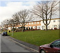
Cowper Close, Gaer, Newport
Houses on the north side of Cowper Close.
The Close is built across steeply sloping land adjacent to Shakespeare Crescent. This results in the houses being set above street level - each one has a flight of steps from street to front door. In common with streets nearby, Cowper Close has no houses on its south side. Instead, there are the back gardens of the next street, Keats Close.
Image: © Jaggery
Taken: 12 Feb 2010
0.02 miles
2
Sirhowy Valley Walk, Gaer, Newport
In the distance can be seen
Image and behind it the River Severn and the North Somerset Coast.
Image: © Robin Drayton
Taken: 11 Aug 2007
0.05 miles
3
Junction of Ruskin Rise and Shakespeare Crescent, Gaer, Newport
Ruskin Rise curves away from Shakespeare Crescent on its descent towards the lower section of Shakespeare Crescent, adjacent to Wells Close.
Image: © Jaggery
Taken: 12 Feb 2010
0.05 miles
4
Trees at the top of Kipling Hill, Gaer, Newport
Viewed from Shakespeare Crescent.
Image: © Jaggery
Taken: 12 Feb 2010
0.06 miles
5
Shakespeare Crescent, Gaer Estate
http://www.geograph.org.uk/photo/621751
Image: © Robin Drayton
Taken: 11 Aug 2007
0.07 miles
6
Track along the eastern edge of Gaer Fort open space, Newport
Viewed from the SW end of Gaer Park Drive. The open space is also known as Tredegar Fort. http://www.geograph.org.uk/photo/619433
Image: © Jaggery
Taken: 6 Oct 2012
0.08 miles
7
Collins Close, Gaer, Newport
Collins Close bends away from Shakespeare Crescent.
These houses are on the north side; on the south side are the back gardens of houses in Cowper Close.
Image: © Jaggery
Taken: 12 Feb 2010
0.08 miles
8
On the eastern edge of Gaer Fort, Newport
Towards the edge of Gaer Estate.
Image: © Robin Drayton
Taken: 28 Aug 2021
0.08 miles
9
Keats Close, Gaer, Newport
Houses on the north side of Keats Close.
The Close is built across steeply sloping land adjacent to Shakespeare Crescent. This results in the houses being set above street level. In common with streets nearby, Keats Close has no houses on its south side. Instead, there are the back gardens of the next street, Sheridan Close.
Image: © Jaggery
Taken: 12 Feb 2010
0.08 miles
10
Sheridan Close, Gaer, Newport
Viewed from the Shakespeare Crescent end.
Image: © Jaggery
Taken: 12 Feb 2010
0.08 miles


