1
Cae Brynton Road and man made cumulus clouds
After a wet night, the conditions were just right for this cloud to form from the heat of the Uskmouth power station.
For another example, under different conditions, see http://www.geograph.org.uk/photo/1063480 .
Image: © Robin Drayton
Taken: 28 Jan 2009
0.01 miles
2
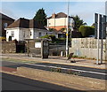
Cardiff Road bus shelter at the edge of Cae Brynton Road, Newport
The bus stop has a frequent bus service towards the city centre because several routes have come together by this point, about 2km from the bus station. There is no vehicular access http://www.geograph.org.uk/photo/2173801 from Cae Brynton Road, behind the bus shelter, to Cardiff Road, though it used to be a through route.
Image: © Jaggery
Taken: 24 Oct 2013
0.02 miles
3
Oaks Close
Named after The Oaks, a detached house that existed nearby before development in the 1930s.
Image: © Robin Drayton
Taken: 1 Dec 2008
0.02 miles
4
Cardiff Road bridge reconstruction (4)
Three weeks into the reconstruction work.
Image: © Robin Drayton
Taken: 18 Nov 2015
0.02 miles
5
Cardiff Road bridge reconstruction (10)
Looking down onto the railway line.
The span of old bridge has been removed.
Image: © Robin Drayton
Taken: 26 Dec 2015
0.03 miles
6
Ordnance Survey Cut Mark
This OS cut mark can be found on the NW parapet of the railway bridge on Cardiff Road. It marks a point 17.392m above mean sea level.
Image: © Adrian Dust
Taken: 2 Aug 2021
0.03 miles
7
Cardiff Road bridge reconstruction (7)
Christmas Day and the noisy demolition work continues apace.
Image: © Robin Drayton
Taken: 25 Dec 2015
0.03 miles
8
Newport : Cardiff Road houses between Aubrey Hames Close and Cae Brynton Road
The turning for Aubrey Hames Close http://www.geograph.org.uk/photo/1887489 is on the right.
Image: © Jaggery
Taken: 24 Dec 2010
0.03 miles
9
Snowy railway embankment and Oaks Close, Newport
A snowy scene taken on Christmas Eve 2010. Snow persists from a moderate fall several days earlier. The embankment is between the South Wales main railway lines at Gaer Junction and houses at the far end of Oaks Close. http://www.geograph.org.uk/photo/1133254
Image: © Jaggery
Taken: 24 Dec 2010
0.03 miles
10
Flats, Aubrey Hames Close, Newport
Aubrey Hames Close, on the north side of Cardiff Road, contains modern houses and flats. These flats are at the western end of the close.
The late Aubrey Hames was Mayor of Newport (1977-1978). The Mayor is Newport's First Citizen. The Local Government Act 1972 states that as chairman of the city council, the Mayor has precedence in the city over all but members of the Royal Family or the Lord Lieutenant (the representative of the Royal Family).
Image: © Jaggery
Taken: 24 Dec 2010
0.03 miles


