1
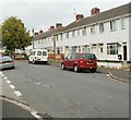
Western arm of Maesglas Grove, Newport
Houses on the north side of a 70 metre arm of Maesglas Grove. The arm ends at the entrance gates http://www.geograph.org.uk/photo/2533891to Maesglas Grove Allotments. Viewed from the corner of the main section of Maesglas Grove.
Image: © Jaggery
Taken: 2 Aug 2011
0.01 miles
2
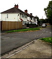
Entrance gates, Maesglas Grove Allotments, Newport
The gate is at the end of the short western arm http://www.geograph.org.uk/photo/2533887 of Maesglas Grove. The allotment site is one of 22 owned by Newport City Council. For a small annual fee, local residents can hire a plot of land for growing vegetables, fruit or flowers.
The houses in the background are part of St Brides Crescent.
Image: © Jaggery
Taken: 2 Aug 2011
0.01 miles
3
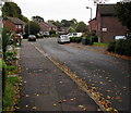
Eastern end of St Brides Crescent, Newport
At the end of the roadway ahead, a footpath http://www.geograph.org.uk/photo/2533929 leads to Maesglas Grove.
Image: © Jaggery
Taken: 2 Aug 2011
0.01 miles
4
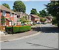
St Brides Crescent, Newport
Cul-de-sac on the southeast side of Cardiff Road.
Image: © Jaggery
Taken: 11 Oct 2017
0.03 miles
5
Autumn view of St Brides Gardens, Newport
Cul-de-sac on the southeast side of Cardiff Road viewed on October 11th 2017.
Image: © Jaggery
Taken: 11 Oct 2017
0.03 miles
6
Cardiff Road houses viewed from Old Cardiff Road, Newport
Viewed from the bus stop opposite St Thomas's church. http://www.geograph.org.uk/photo/1925485
Image: © Jaggery
Taken: 2 Aug 2011
0.05 miles
7
St Brides Gardens, Newport
Houses on the northeast side of the street, viewed from the Cardiff Road end.
Image: © Jaggery
Taken: 20 Jun 2010
0.06 miles
8
St Brides Crescent, Newport
Viewed from the Cardiff Road end.
Image: © Jaggery
Taken: 20 Jun 2010
0.06 miles
9
Maesglas Crescent houses near the corner of Maesglas Grove, Newport
The right turn is into Maesglas Grove.
Image: © Jaggery
Taken: 2 Aug 2011
0.06 miles
10
Maesglas Grove, Newport
Houses on the corner of a short western arm of Maesglas Grove. The arm http://www.geograph.org.uk/photo/2533887 on the right, leads to the entrance gates http://www.geograph.org.uk/photo/2533891 to Maesglas Grove allotments.
Image: © Jaggery
Taken: 2 Aug 2011
0.06 miles


