1
A view across Newport from the Royal Gwent Hospital [5]
The area in the foreground that has been cleared is the site of the former Whiteheads Steel Works http://www.geograph.org.uk/photo/1044187 .
The hill in the background is on the Newport City Waste Disposal Site and is man made http://www.geograph.org.uk/photo/471790 .
Image: © Robin Drayton
Taken: 16 May 2009
0.04 miles
2
Lloyds Pharmacy, Belle Vue Terrace, Newport
There are two pharmacies, a clinic and a surgery clustered together in Belle Vue Terrace. This is Lloyds Pharmacy, located close to the Mendalgief Road junction. Part of the Royal Gwent Hospital http://www.geograph.org.uk/photo/527560 is in the background.
Image: © Jaggery
Taken: 30 Nov 2009
0.05 miles
3
Newport : Mendalgief Road houses north of Arthur Street
These are the northernmost houses on Mendalgief Road. They face derelict land, formerly a factory site.
The multi-storey building in the background is part of the Royal Gwent Hospital. http://www.geograph.org.uk/photo/527560
Image: © Jaggery
Taken: 16 Oct 2011
0.05 miles
4
Arthur Street, Newport
From the corner of Belle Vue Terrace, Arthur Street extends for 160 metres to Mendalgief Road.
Image: © Jaggery
Taken: 29 Oct 2017
0.06 miles
5
Arthur Street, Newport
The edge of Spring Gardens residential care home, on the north side of Arthur Street, viewed from Mendalgief Road.
Image: © Jaggery
Taken: 30 Nov 2009
0.06 miles
6
Newport : Arthur Street side of Spring Gardens care home
Spring Gardens is a residential care home owned by Newport City Council, located on the corner of Mendalgief Road and Arthur Street. It caters for 34 elderly people with dementia.
Image: © Jaggery
Taken: 24 Dec 2010
0.06 miles
7
Newport : Mendalgief Road houses between Robert Close and Arthur Street
Viewed across the corner of Mendalgief Road and Robert Close.
Image: © Jaggery
Taken: 16 Oct 2011
0.06 miles
8
Detail of railings in Mendalgief Road
Image: © Rod Allday
Taken: 7 May 2015
0.07 miles
9
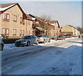
Houses and cars, Mendalgief Road, Newport
The corner of Belle Vue Terrace http://www.geograph.org.uk/photo/5613619 is on the left. This is the only Mendalgief anything (Road or Street or Avenue etc) in the UK. The origin of the name is obscure. The Newport Past website records that this area was referred to as Mendelgif in 1239 and Myndylgyffe in 1447.
Image: © Jaggery
Taken: 29 Oct 2017
0.07 miles
10
Railings in Mendalgief Road
Alongside a derelict industrial site.
Image: © Rod Allday
Taken: 7 May 2015
0.07 miles


![A view across Newport from the Royal Gwent Hospital [5]](https://s1.geograph.org.uk/geophotos/01/31/93/1319381_93cb93f8_120x120.jpg)


