1
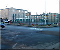
View across Pillgwenlly, Newport
Taken from the Royal Gwent Hospital https://www.geograph.org.uk/photo/5565199 .
With Cardiff Road in the foreground and on the horizon, City Bridge (to the left) https://www.geograph.org.uk/photo/3948224 and Transporter Bridge (to the right) https://www.geograph.org.uk/photo/666383 .
Image: © Robin Drayton
Taken: 24 Mar 2019
0.03 miles
2
A view across Newport from the Royal Gwent Hospital [2]
Looking across the Pillgwenlly area of Newport towards the City Bridge http://www.geograph.org.uk/photo/1140452 .
Image: © Robin Drayton
Taken: 16 May 2009
0.03 miles
3
Basketball court, Francis Drive, Newport
Francis Drive is on the west side of Commercial Road. Vehicle access is from Alma Street.
Image: © Jaggery
Taken: 15 Dec 2010
0.03 miles
4
Capel Crescent, Newport
Capel Crescent heads away from Commercial Road.
On the left is Clare food store http://www.geograph.org.uk/photo/1791995 ; on the right is A F Thomas & Sons Ltd, electrical retailers. http://www.geograph.org.uk/photo/1791864
Image: © Jaggery
Taken: 5 Oct 2009
0.04 miles
5
Capel Close, Newport
Viewed across the eastern end of Capel Crescent, near the Commercial Road junction. The seven properties http://www.geograph.org.uk/photo/2207314 in Capel Close are out of shot on the left.
Image: © Jaggery
Taken: 15 Dec 2010
0.04 miles
6
Capel Close houses, Newport
Capel Close contains 7 modern houses. The close connects with the eastern end of Capel Crescent, near the Commercial Road junction.
Image: © Jaggery
Taken: 24 Dec 2010
0.04 miles
7
Capel Close mural, Pill, Newport
Capel Close is on the north side of Capel Crescent near the Commercial Road junction in the Pill area of Newport.
Image: © Jaggery
Taken: 29 Oct 2017
0.07 miles
8
Capel Close, Pill, Newport
From Capel Crescent along Capel Close towards a mural http://www.geograph.org.uk/photo/5616600 in the Pill area of Newport.
Image: © Jaggery
Taken: 29 Oct 2017
0.08 miles
9
Former Newport Mini Market, Commercial Road
Viewed from the corner of Bolt Street. Now closed, Newport Mini Market dealt in an unusual mix of food: Polish, Lithuanian and Middle Eastern.
A relic survives a few inches above the pavement, near a red post. It is a Raglan Street sign. Raglan Street disappeared when the area now known as Francis Drive was redeveloped.
UPDATE December 2011. The building is now occupied by AZZ Designer Radiators. http://www.geograph.org.uk/photo/2721045
Image: © Jaggery
Taken: 5 Oct 2009
0.09 miles
10
Antalya, Commercial Road, Newport
There is a wide range of cuisines available from restaurants and takeaways in Commercial Road.
This one is Antalya Kebab and Pizza House, 156 Commercial Road.
Image: © Jaggery
Taken: 5 Oct 2009
0.09 miles


![A view across Newport from the Royal Gwent Hospital [2]](https://s0.geograph.org.uk/geophotos/01/31/56/1315636_5be397ef_120x120.jpg)


