1
Rear windows, Belle Vue Terrace, Newport
The backs of Arthur Street houses viewed across Belle Vue Terrace.
Image: © Jaggery
Taken: 29 Oct 2017
0.00 miles
2
Kingdom Hall, Capel Crescent, Newport
Located behind an electricity substation on Capel Crescent. A Kingdom Hall is a place of worship used by Jehovah's Witnesses. They use the term rather than church because the biblical use of church usually refers to the congregation of people rather than a structure.
Image: © Jaggery
Taken: 15 Dec 2010
0.00 miles
3
Entrance to Capel Crescent allotments, Newport
Viewed about an hour before sunset in mid-December. The allotments, on the south side of Capel Crescent, are one of 22 sites owned by Newport City Council. Residents of the city may apply to the council to rent an allotment plot, to be used for growing vegetables, flowers, etc.
Image: © Jaggery
Taken: 15 Dec 2010
0.00 miles
4
Pill Harriers Sports Club, Newport
The club faces the corner of Belle Vue Terrace and Arthur Street. It is at the NW edge of a recreation ground. In season 2010-2011, Pill Harriers RFC (Rugby Football Club) play in the Welsh Rugby Union Division Three East (also known as SWALEC Division Three East).
Image: © Jaggery
Taken: 17 Dec 2010
0.00 miles
5
Row of houses in Arthur Street, Newport
The 50 metre long row is opposite Arthur Close. Ahead are Spring Gardens and Mendalgief Road.
Image: © Jaggery
Taken: 12 Jul 2014
0.01 miles
6
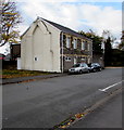
Evidence of a longer row of houses, Belle Vue Terrace, Newport
The appearance of the side wall and the open space beyond suggest that the semi-detached houses used to be part of a longer row of houses.
Image: © Jaggery
Taken: 29 Oct 2017
0.02 miles
7
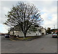
Tree at a V-junction, Pill, Newport
The V-shaped junction of Arthur Street (on the left) and Belle Vue Terrace in the Pill area of Newport.
Image: © Jaggery
Taken: 29 Oct 2017
0.02 miles
8
Two stone semi-detached houses, Belle Vue Terrace, Newport
Probably dating from the 19th century when Belle Vue Terrace was Courtybella Terrace.
Image: © Jaggery
Taken: 29 Oct 2017
0.03 miles
9
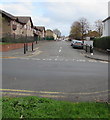
Arthur Street, Newport
From Mendalgief Road along Arthur Street towards Arthur Close and Belle Vue Terrace.
Image: © Jaggery
Taken: 29 Oct 2017
0.03 miles
10
Bellevue Group Practice car park, Newport
The car park on the east side of Bellevue Group Practice http://www.geograph.org.uk/photo/5613575 is for practice visitors parking only.
Image: © Jaggery
Taken: 29 Oct 2017
0.03 miles


