1
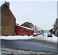
Carlisle Street, Newport
Looking towards Alexandra Road and St Stephens Church. http://www.geograph.org.uk/photo/666387
Image: © Jaggery
Taken: 30 Nov 2009
0.01 miles
2
St Stephen's Road, Newport
Houses on the west side of St Stephen's Road, viewed from the corner of Carlisle Street.
Image: © Jaggery
Taken: 30 Nov 2009
0.01 miles
3
Newport : Milman Street east of Alexandra Road
Viewed across Alexandra Road from the western side of Milman Street. In the distance, the far end of Milman Street connects with Carlisle Street at a sharp bend.
Image: © Jaggery
Taken: 23 Dec 2010
0.01 miles
4
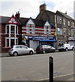
JMG Convenience Store, Alexandra Road, Newport
Off licence and groceries shop at 75 Alexandra Road.
Image: © Jaggery
Taken: 29 Oct 2017
0.01 miles
5
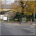
Telecoms cabinets on a Pill corner, Newport
A dark green BT cabinet on the right and a Virgin Media cabinet a couple of metres to its left are on the corner of Alexandra Road and Pottery Terrace in the Pill area of Newport. St Stephen's church hall and church are in the background.
Image: © Jaggery
Taken: 29 Oct 2017
0.02 miles
6
Three Alexandra Road shops, Newport
From left to right are Chun Ho Chinese and English takeaway, Pick 'n' Mix
convenience store and Cornerstone Bakery, on the corner of Alice Street.
Image: © Jaggery
Taken: 20 Jul 2014
0.02 miles
7
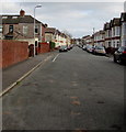
Alice Street, Newport
From Mendalgief Road behind the camera, Alice Street extends for 235 metres to Pottery Terrace and Alexandra Road.
Image: © Jaggery
Taken: 29 Oct 2017
0.02 miles
8
Alice Street, Newport
Terrace houses on Alice Street in Newport.
Image: © Philip Halling
Taken: 11 May 2013
0.02 miles
9
Cornerstone Bakery, 42 Alexandra Road, Newport
On the corner of Alice Street.
Image: © Jaggery
Taken: 29 Oct 2017
0.02 miles
10
Docks Conservative Club, Newport
On the corner of Alice Street and Pottery Terrace, viewed from Alexandra Road.
Image: © Jaggery
Taken: 20 Jul 2014
0.02 miles


