1
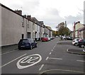
Royal Oak pub, Pill, Newport
Pub on the corner of Jeddo Street and Courtybella Terrace.
Image: © Jaggery
Taken: 15 Dec 2010
0.03 miles
2
Raglan Court, Capel Crescent, Newport
Built in 1980, Raglan Court contains 58 rented flats and bungalows, designed for people aged at least 60. There is a non-resident management staff and community alarm service. This view is in the direction of Commercial Road.
Image: © Jaggery
Taken: 15 Dec 2010
0.04 miles
3
Capel Court and Capel Grange, Newport
Two adjacent modern buildings on the south side of Capel Crescent.
Capel Court, opened in February 2008, contains 40 flats. It was built by Linc-Cymru in partnership with Newport City Council. It is Newport’s third extraCare scheme, designed to accommodate older people in need of care.
Capel Grange is a 3-storey building. 12 of its 70 beds are dedicated EMI (elderly, mentally infirm) nursing beds. The other beds are for general nursing of the elderly in need of long-term medical care.
Image: © Jaggery
Taken: 15 Dec 2010
0.04 miles
4
Capel Crescent allotments, Newport
Viewed from the NE corner of the allotments, which are located on the south side of Capel Crescent, one of 22 allotment sites owned by Newport City Council. Residents of the city may apply to the council to rent an allotment plot, to be used for growing vegetables, flowers, etc.
The blanket of snow helps reduce heat loss from the soil and maintains a higher temperature underneath than would be the case if the allotments were bare.
Image: © Jaggery
Taken: 24 Dec 2010
0.04 miles
5
Temple Street, Pill, Newport
From Commercial Road behind the camera, Temple Street extends for 150 metres to the edge of a recreation ground. The 20mph speed limit on Commercial Road increases to 30mph ahead.
Image: © Jaggery
Taken: 29 Oct 2017
0.06 miles
6
Pill Millennium Centre, Newport
Viewed from the far end of Temple Street. The Centre is a Community Regeneration Charity for the disadvantaged area of Pill(gwenlly). The aim is to encourage participation in recreation, leisure and cultural activities.
Image: © Jaggery
Taken: 15 Dec 2010
0.06 miles
7
Pillgwenlly Primary School, Newport
Located on the north side of Capel Crescent. The school is a mixed primary and nursery school. Pillgwenlly is the official name for the area of Newport usually referred to as Pill.
Image: © Jaggery
Taken: 24 Dec 2010
0.06 miles
8
A view across Newport from the Royal Gwent Hospital [3]
Looking across the Pillgwenlly area of Newport towards the Transporter Bridge http://www.geograph.org.uk/photo/666383 .
Image: © Robin Drayton
Taken: 16 May 2009
0.08 miles
9
New Street, Pill, Newport
New Street is a short cul-de-sac on the west side of Commercial Road. Viewed from the corner of Potter Street.
Image: © Jaggery
Taken: 5 Oct 2009
0.08 miles
10
Former Pill library, Newport
The late Victorian building, on the north side of Temple Street, was originally a Newport library branch reading room, later upgraded to a branch lending library. In January 2009, library services were transferred to a new branch in Commercial Road, http://www.geograph.org.uk/photo/1975553 The building is now the headquarters of Pillgwenlly Community First.
Inscribed in stone above the top floor central window is
KNOWLEDGE IS POWER
Above that, 1889 is inscribed in the pediment (topmost triangular stone).
Image: © Jaggery
Taken: 15 Dec 2010
0.08 miles


![A view across Newport from the Royal Gwent Hospital [3]](https://s1.geograph.org.uk/geophotos/01/31/56/1315645_8d7799b8_120x120.jpg)

