1
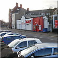
Former Lilo Grill House to let, Newport
Located on the corner of Cardiff Road and King Street. There is a To Let sign above the doorway near the zebra crossing. Lilo Grillhouse Inn Ltd, incorporated in January 2011, was dissolved on January 3rd 2013. The previous occupier was the Prince of Wales pub. http://www.geograph.org.uk/photo/1597334 Who will be the next occupier?
Image: © Jaggery
Taken: 22 Jan 2013
0.01 miles
2
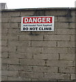
No climbing on Robbins Lane
Sign high up on a wall at the end of Robbins Lane. At the time the photo was taken, no vandal was available for testing the efficacy of the paint.
Image: © Jaggery
Taken: 13 Aug 2009
0.02 miles
3
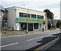
Former King William IV pub, Newport
Boarded up and long closed, this derelict building on the corner of Commercial Street and Kingsway is the former King William IV pub.
Image: © Jaggery
Taken: 27 Nov 2009
0.02 miles
4
Hussaini Mission Jamia Masjid, Newport
1 Commercial Road. Built in 1829. Kelly's Directory 1901 shows the building was occupied by the Welsh Calvinistic Methodist Chapel.
Hussaini Mission bought the premises in 1986. Capacity of the Jamia Masjid is 700 worshippers.
Image: © Jaggery
Taken: 27 Nov 2009
0.02 miles
5
Prince of Wales, Newport
2 Cardiff Road.
Update May 2010. The pub is closed and for sale. http://www.geograph.org.uk/photo/1886987
Image: © Jaggery
Taken: 27 Nov 2009
0.02 miles
6
Rileys, Kingsway Newport
Snooker and pool club, with a bar. Viewed from the edge of Ebenezer Terrace. http://www.geograph.org.uk/photo/1597412
Image: © Jaggery
Taken: 14 Feb 2010
0.02 miles
7
JP Stores display premises, Kingsway, Newport
Located at 1A Kingsway. A notice in the window states that all items on display are available in the JP Stores premises around the corner in Commercial Street.
JP Stores specialise in items for the home, such as carpets, rugs, bathroom accessories and bedding.
Image: © Jaggery
Taken: 14 Feb 2010
0.02 miles
8
The southern end of Commercial Street, Newport
A block of shops at the end (or beginning) of Commercial Street, where it joins Cardiff Road. Viewed from Kingsway. Premises include
Georgiou, hair designers.
Thai Thara, Thai cuisine.
Town Balti, tandoori restaurant and takeaway.
Image: © Jaggery
Taken: 14 Feb 2010
0.02 miles
9
Nationwide Autocentre, Kingsway, Newport
Car servicing, repairs and MOT test centre, located at the southern end of Kingsway.
Nationwide Autocentres has about 220 AA-approved service centres in the UK.
Image: © Jaggery
Taken: 30 May 2010
0.02 miles
10
Prince of Wales for sale, Newport
The pub, at the corner of Cardiff Road and King Street, has its door and ground floor windows boarded up, with a For Sale sign on one of the windows. A roundel at the top of the building shows PRINCE OF WALES HOTEL 1890.
http://www.geograph.org.uk/photo/1597334 to a view from a different angle, when the pub was open.
Image: © Jaggery
Taken: 30 May 2010
0.02 miles


