1
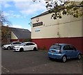
Second hand shop, Tredegar Street
Near the entrance to Newport Cattle Market. http://www.geograph.org.uk/photo/995431
Image: © Robin Drayton
Taken: 1 Oct 2008
0.01 miles
2
Tredegar Street
Looking towards the entrance to the cattle market. http://www.geograph.org.uk/photo/995431
Image: © Robin Drayton
Taken: 1 Oct 2008
0.01 miles
3
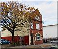
West Market Street, Newport
At the junction with Tredegar Street.
At the side of Newport Cattle Market the former White Hart Public House is to the left
Image: © Geographer
Taken: Unknown
0.01 miles
4
Tredegar Street
At the end of the street is the side entrance to a new Asda superstore.
For the same view about one year earlier see http://www.geograph.org.uk/photo/1059364 .
Image: © Robin Drayton
Taken: 17 Nov 2009
0.01 miles
5
Newport Ambulance Station, Pill, Newport
Set back from the north side of Albert Street in the Pill area of Newport.
Image: © Jaggery
Taken: 24 Jun 2018
0.02 miles
6
Relic of the former White Hart pub, Pill, Newport
In October 2017, the White Hart name and an Ushers of Trowbridge sign remain on White Hart House, currently the premises of Cambrian Fuelcard Services whose nameboard is also on the wall. This photo http://www.geograph.org.uk/photo/588909 taken in 1975 shows the White Hart pub.
Image: © Jaggery
Taken: 29 Oct 2017
0.02 miles
7
BT phonebox and a tree at the edge of White Hart House, Newport
On the Tredegar Street side of White Hart House, formerly the White Hart pub, seen here http://www.geograph.org.uk/photo/588909 in 1975.
Image: © Jaggery
Taken: 29 Oct 2017
0.02 miles
8
Blue plaque at Newport Cattle Market
Image: © Robin Drayton
Taken: 1 Oct 2008
0.02 miles
9
Newport Ambulance Station, Albert Street, Pill, Newport
Welsh Ambulance Service NHS Trust South East Division site in the Pill area of Newport.
Image: © Jaggery
Taken: 29 Oct 2017
0.02 miles
10
Tredegar Street entrance, Newport Cattle Market
For many years an outdoor general market was held here on a Saturday but this has now moved to a new location. The blue plaque by the entrance gives some historical information. http://www.geograph.org.uk/photo/995428
Image: © Robin Drayton
Taken: 1 Oct 2008
0.02 miles


