IMAGES TAKEN NEAR TO
Delius Close, NEWPORT, NP19 9SL
Introduction
This page details the photographs taken nearby to Delius Close, NP19 9SL by members of the Geograph project.
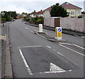
The Geograph project started in 2005 with the aim of publishing, organising and preserving representative images for every square kilometre of Great Britain, Ireland and the Isle of Man.

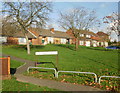
There are currently over 7.5m images from over14,400 individuals and you can help contribute to the project by visiting https://www.geograph.org.uk
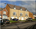
Image Map
Images are licensed for reuse under creativecommons.org/licenses/by-sa/2.0
Notes
- Clicking on the map will re-center to the selected point.
- The higher the marker number, the further away the image location is from the centre of the postcode.
Image Listing (107 Images Found)
Images are licensed for reuse under creativecommons.org/licenses/by-sa/2.0
Image
Details
Distance
1
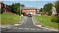
Purcell Square, Alway
Viewed from Vaughan Williams Drive.
Image: © Jaggery
Taken: 10 Sep 2009
0.04 miles
2
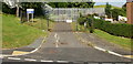
Ladyhill Service Reservoir
The entrance off Vaughan Williams Drive to the locked and fenced Ladyhill water reservoir. It is a covered reservoir located at one of the highest points in this part of Newport.
Image: © Jaggery
Taken: 10 Sep 2009
0.04 miles
3

Walford Davies Drive, Alway
Walford Davies Drive viewed from Vaughan Williams Drive.
Image: © Jaggery
Taken: 10 Sep 2009
0.07 miles
4
Vaughan Williams Drive, Alway, Newport
Looking past a speed bump and a pedestrian refuge between Keep Left signs.
Image: © Jaggery
Taken: 29 Jan 2020
0.14 miles
5
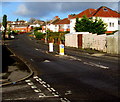
Alway Crescent, Newport
Houses on the south side of Alway Crescent.
Image: © Jaggery
Taken: 17 Dec 2009
0.15 miles
6
New housing, Alway Crescent, Newport
A few of the several hundred houses being constructed as part of the Alway regeneration scheme.
Image: © Jaggery
Taken: 17 Dec 2009
0.15 miles
8
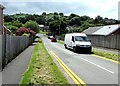
Down Ringwood Hill, Newport
Ringwood Hill descends from Chepstow Road towards East Grove Road. Ladyhill Wood is in the background.
Image: © Jaggery
Taken: 21 Jun 2019
0.16 miles
9
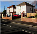
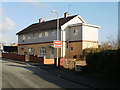
Houses at the eastern end of Liswerry Road, Alway, Newport
Viewed from the corner of Aberthaw Avenue.
Image: © Jaggery
Taken: 29 Jan 2020
0.17 miles
10
Vaughan Williams Drive speed bump, Alway, Newport
On the approach to a school. A triangular warning sign showing School is ahead.
Image: © Jaggery
Taken: 2 Jul 2016
0.17 miles