1
Aberthaw Circle, Alway, Newport
Aberthaw Circle ascends from Aberthaw Road towards Aberthaw Close.
Image: © Jaggery
Taken: 2 Jul 2016
0.07 miles
2
Junction of Aberthaw Road and East Grove Road, Alway, Newport
Viewed across Aberthaw Road. East Grove Road extends for about 500 metres to Ringwood Hill.
Image: © Jaggery
Taken: 2 Jul 2016
0.08 miles
3
West side of Aberthaw Circle, Alway, Newport
The shape of Aberthaw Circle resembles an oblong, but neither Oblong nor Rectangle appear to be used for UK street names, though Circle, Square and Crescent are much used, and Triangle to a lesser extent.
Image: © Jaggery
Taken: 2 Jul 2016
0.08 miles
4
West side of Alway Primary School, Newport
Viewed from Aberthaw Circle. http://www.geograph.org.uk/photo/5216631 to the south side of the school.
Image: © Jaggery
Taken: 2 Jul 2016
0.09 miles
5
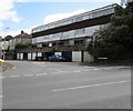
East Grove Road housing above lockup garages, Alway, Newport
At the SW end of East Grove Road, viewed across Aberthaw Road.
Image: © Jaggery
Taken: 2 Jul 2016
0.09 miles
6
South side of Alway Primary School, Newport
Viewed across Aberthaw Road. Built in 1951 as separate Infant and Junior schools which amalgamated in 2002 to create Alway Primary School. There are currently (2016) about 400 pupils enrolled including a 20 place Learning Support Centre and Nursery.
Image: © Jaggery
Taken: 2 Jul 2016
0.10 miles
7
20 on Aberthaw Circle, Alway, Newport
A 20mph speed limit is in force near Alway Primary School. http://www.geograph.org.uk/photo/5216631
Image: © Jaggery
Taken: 2 Jul 2016
0.10 miles
8
Alway Primary School, Newport
Viewed across Aberthaw Road. Built in 1951 as separate Infant and Junior schools which amalgamated in 2002 to create Alway Primary School. There are currently (2016) about 400 pupils enrolled including a 20 place Learning Support Centre and Nursery.
Image: © Jaggery
Taken: 2 Jul 2016
0.10 miles
9
Outdoor activities area, Alway Primary School, Newport
In the southwest corner of the school site, viewed from Aberthaw Road.
Image: © Jaggery
Taken: 2 Jul 2016
0.11 miles
10
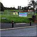
Banners on Alway Primary School railings, Newport
The larger banner facing the corner of Aberthaw Road and Aberthaw Circle advertises the Alway Primary School Summer Fayre on Saturday 2nd July (later today). The smaller banner is for Llanwern High School, to which most Alway Primary School pupils will go when their primary years are over.
Image: © Jaggery
Taken: 2 Jul 2016
0.11 miles


