IMAGES TAKEN NEAR TO
Glanwern Avenue, NEWPORT, NP19 9BW
Introduction
This page details the photographs taken nearby to Glanwern Avenue, NP19 9BW by members of the Geograph project.
The Geograph project started in 2005 with the aim of publishing, organising and preserving representative images for every square kilometre of Great Britain, Ireland and the Isle of Man.

There are currently over 7.5m images from over14,400 individuals and you can help contribute to the project by visiting https://www.geograph.org.uk
Image Map
Images are licensed for reuse under creativecommons.org/licenses/by-sa/2.0
Notes
- Clicking on the map will re-center to the selected point.
- The higher the marker number, the further away the image location is from the centre of the postcode.
Image Listing (51 Images Found)
Images are licensed for reuse under creativecommons.org/licenses/by-sa/2.0
Image
Details
Distance
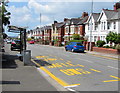
1
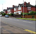
Brick semis, Chepstow Road, Newport
Semi-detached houses alongside the B4237 Chepstow Road.
Image: © Jaggery
Taken: 21 Jun 2019
0.03 miles
2
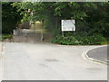
Steps at the top end of Quantock Drive, Newport
At the top end of Quantock Drive a series of steps, interspersed with short stretches of steep pathway, climb towards Cotswold Close.
On the right is the entrance to Danygraig Nursing Home and Osborne Children's Nursery.
Image: © Jaggery
Taken: 24 Jun 2010
0.07 miles
3
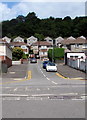
Cotswold Close, Newport
The view from the corner of Cotswold Way.
Image: © Jaggery
Taken: 24 Jun 2010
0.07 miles
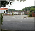
4
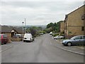
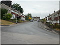
Glanwern Drive, Newport
Glanwern Drive ascends from Chepstow Road towards Glanwern Avenue.
Wooded Lawrence Hill is in the background.
Image: © Jaggery
Taken: 21 Jun 2019
0.07 miles
5
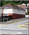
Glanwern Drive telecoms cabinets, Newport
Viewed across the B4237 Chepstow Road.
Image: © Jaggery
Taken: 21 Jun 2019
0.08 miles
6
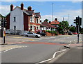
Chepstow Road pelican crossing near crossroads, Newport
Across the B4237 Chepstow Road near the Glanwern Drive and Ringwood Hill junctions. Chambers Dictionary states that pelican in this context is adapted from pedestrian light controlled crossing.
Image: © Jaggery
Taken: 21 Jun 2019
0.08 miles
7
Ringwood Avenue, Newport
Viewed from the shade of a tree on Chepstow Road, Ringwood Avenue heads towards Ringland Circle, about 500 metres distant.
Image: © Jaggery
Taken: 24 Jun 2010
0.09 miles
8
Chepstow Road bus stop and shelter near Ringwood Hill, Newport
This stop is for buses to the city centre via Beechwood and Maindee.
SAFLE BWS on the road surface is Welsh for BUS STOP.
Image: © Jaggery
Taken: 21 Jun 2019
0.10 miles
9
Southwest side of Cotswold Way, Newport
The view along Cotswold Way from Quantock Drive.
Image: © Jaggery
Taken: 24 Jun 2010
0.10 miles
10
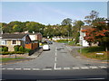
Quantock Drive, Newport
Looking along Quantock Drive from Chepstow Road.
Image: © Jaggery
Taken: 18 Oct 2009
0.10 miles