IMAGES TAKEN NEAR TO
Meadows Road, NEWPORT, NP19 4SS
Introduction
This page details the photographs taken nearby to Meadows Road, NP19 4SS by members of the Geograph project.
The Geograph project started in 2005 with the aim of publishing, organising and preserving representative images for every square kilometre of Great Britain, Ireland and the Isle of Man.

There are currently over 7.5m images from over14,400 individuals and you can help contribute to the project by visiting https://www.geograph.org.uk
Image Map
Images are licensed for reuse under creativecommons.org/licenses/by-sa/2.0
Notes
- Clicking on the map will re-center to the selected point.
- The higher the marker number, the further away the image location is from the centre of the postcode.
Image Listing (32 Images Found)
Images are licensed for reuse under creativecommons.org/licenses/by-sa/2.0
Image
Details
Distance
1
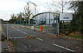
Delta House, Meadows Road
The entrance to Delta House.
The sign states that the premises are occupied by Carter & Carter Group PLC, a British based company that provided outsourced training services and apprenticeships on behalf of various international companies and UK government organisations, such as the Learning and Skills Council. In March 2008, Carter & Carter entered into administration after it failed to reach agreement with its banks about financial restructuring.
Image: © Jaggery
Taken: 5 Nov 2009
0.05 miles
2
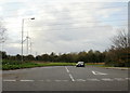
Nash Road junction
Nash Road heads away from Meadows Road. On the left are the two wind turbines http://www.geograph.org.uk/photo/1585741 located on the southern edge of the Solutia site.
Image: © Jaggery
Taken: 5 Nov 2009
0.13 miles
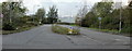
3
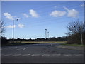
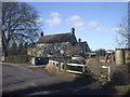
Junction of Nash Rd and Meadows Rd, Newport
Image: © John Lord
Taken: 30 Jan 2010
0.15 miles
6
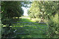
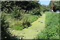
Track to fields from Nash Road
Gated track from bridge over Lakes Reen, Nash Road.
Image: © M J Roscoe
Taken: 30 Jul 2020
0.16 miles
7
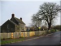
Pye Corner Farm
On the corner of Broadstreet Common and Nash Road and opposite to Image
Grade II listed.
Image: © Robin Drayton
Taken: 9 Dec 2009
0.16 miles
8
No vehicular access to Tatton Road, Newport
On the southern edge of Queensway Meadows Industrial Estate, the Meadows Road access for vehicles to Tatton Road is now blocked by rocks and a metal barrier. The far side of Tatton Road ends in fields and the only manmade structures now along its length are electricity pylons and street lights.
In May 2009, local press reported that a waste disposal plant to take rubbish from five local authority areas could be built on Welsh Assembly-owned land alongside Tatton Road.
Image: © Jaggery
Taken: 5 Nov 2009
0.17 miles
9
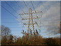
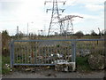
Terminal pylon, Nash Mead, Newport
This pylon, located on the corner of Meadows Road and Nash Mead, is at the end of power lines from the south. About 100 metres north is another terminal pylon http://www.geograph.org.uk/photo/1778044 facing north.
In between, seen here, are power lines running from west to east.
Image: © Jaggery
Taken: 23 Jan 2010
0.17 miles
10
Nash Mead, Newport
The view from Meadows Road.
Image: © Jaggery
Taken: 5 Nov 2009
0.17 miles