1
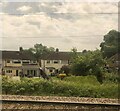
Unnamed reen, Thompson Avenue, Newport
Partly hidden by early August vegetation, a reen (drainage channel) emerges from a culvert carrying it under Thompson Avenue.
Image: © Jaggery
Taken: 10 Aug 2011
0.03 miles
2
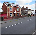
Back gardens, Thompson Avenue
Image: © Eirian Evans
Taken: 10 Jun 2022
0.03 miles
3
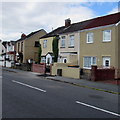
Thompson Avenue, Liswerry, Newport
Houses on the east side of Thompson Avenue, viewed from the Moorland Park end of Liswerry Road.
Image: © Jaggery
Taken: 20 Nov 2009
0.03 miles
4
Rooftop solar panels, Liswerry, Newport
On a detached house on the north side of Liswerry Road.
Image: © Jaggery
Taken: 5 Jul 2016
0.05 miles
5
Thompson Avenue, Liswerry, Newport
The southeast end of Thompson Avenue, viewed from the edge of Liswerry Road.
A nearby sign shows that Thompson Avenue leads to Royston Crescent and Thompson Close.
Image: © Jaggery
Taken: 5 Jul 2016
0.05 miles
6
Poplar Cottages, Liswerry, Newport
On the north side of Liswerry Road.
Image: © Jaggery
Taken: 5 Jul 2016
0.05 miles
7
Liswerry Road speed bumps, Newport
White triangles painted on the road surface draw attention to the bumps.
Image: © Jaggery
Taken: 5 Jul 2016
0.06 miles
8
Concrete posts across Thompson Avenue, Liswerry, Newport
Viewed from Liswerry Road in July 2016. Concrete posts prevent any vehicle wider than a motorbike accessing the southeast end of Thompson Avenue. A street plan of Newport c1960 shows that this was a through route at that time.
Image: © Jaggery
Taken: 5 Jul 2016
0.06 miles
9
Liswerry Road houses adjacent to Greenmeadow Road
Viewed from the corner of Greenmeadow Road.
Image: © Jaggery
Taken: 2 Nov 2010
0.07 miles
10
Thompson Close, Newport
A short cul-de-sac connecting with Thompson Avenue.
Image: © Jaggery
Taken: 10 Aug 2011
0.07 miles


